Alameda in Alameda County, California — The American West (Pacific Coastal)
Alameda City Hall
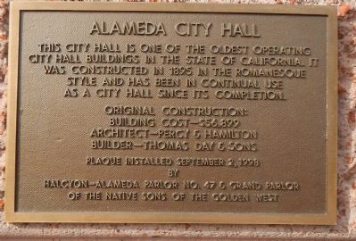
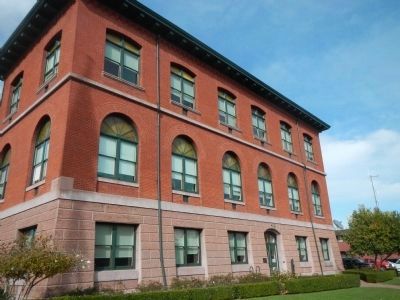
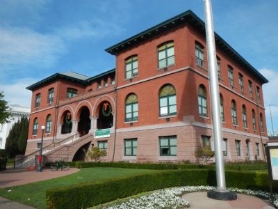
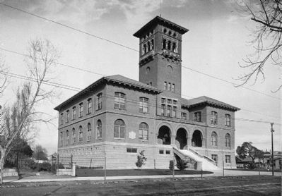
This city hall is one of oldest operating city hall buildings in the State of California. It was constructed in 1895 in the Romanesque style and has been in continual use as a city hall since its completion.
Original construction:
Building cost - $56,899
Architect – Percy & Hamilton
Builder – Thomas Day & Sons
Erected 1998 by Native Sons of the Golden West, Halcyon-Alamedea Parlor No. 47 & Grand Parlor.
Topics and series. This historical marker is listed in these topic lists: Architecture • Government & Politics. In addition, it is included in the Native Sons/Daughters of the Golden West series list. A significant historical year for this entry is 1895.
Location. 37° 45.983′ N, 122° 14.596′ W. Marker is in Alameda, California, in Alameda County. Marker is on Oak Street near Santa Clara Avenue. This marker is located at the Oak Street entrance of the Alameda City Hall. Touch for map. Marker is at or near this postal address: 2263 Santa Clara Avenue, Alameda CA 94501, United States of America. Touch for directions.
Other nearby markers. At least 8 other markers are within walking distance of this marker. Alameda City Hall, 1895-96 (within shouting distance of this marker); Tonarigumi (within shouting distance of this marker); Alameda Lodge No. 1015 (within shouting distance of this marker); They Brought Alameda the News (about 500 feet away, measured in a direct line); Alameda’s First Church (about 600 feet away); a different marker also named Tonarigumi (approx. 0.2 miles away); Historic Alameda High School (approx. 0.2 miles away); Veterans Memorial Building (approx. 0.2 miles away). Touch for a list and map of all markers in Alameda.
Also see . . . Historic American Buildings Survey record for the Alameda City Hall. 5 photos and 20+ page monograph on the Alameda City Hall. From the Statement of Significance: ...Constructed a little over twenty years after the City received its charter in 1872, the building summed up the civic aspirations of the Alameda citizenry. Because the City of Alameda was the first in California and the second in the United States to operate its own power plant, opened in 1886, the City Hall had the benefit of incandescent lighting, a significant luxury. Monumentally conceived by George Percy of the firm Percy and Hamilton, the design reflects the current fashion for the Romanesque Revival Style initiated in this country by Henry Hobson Richardson and used in his famous Allegheny County Courthouse design of 1884-1890.
The Alameda City Hall modestly echoes that building in its general format. The firm of Percy & Hamilton designed about 200 buildings in the San Francisco Bay Area including the notable Stanford University Art Museum and the Children's Playhouse in Golden Gate Park. (Submitted on January 5, 2013.)
Credits. This page was last revised on February 18, 2021. It was originally submitted on December 29, 2012, by Barry Swackhamer of Brentwood, California. This page has been viewed 1,331 times since then and 50 times this year. Photos: 1, 2, 3. submitted on December 29, 2012, by Barry Swackhamer of Brentwood, California. 4. submitted on January 5, 2013. • Syd Whittle was the editor who published this page.


