Eureka Springs in Carroll County, Arkansas — The American South (West South Central)
The Stone Walls
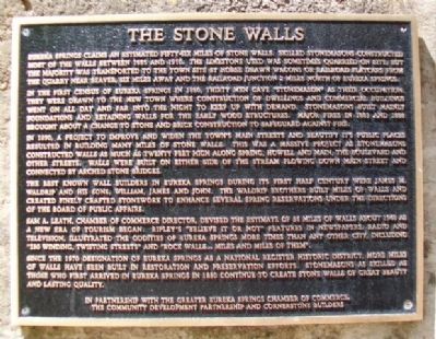
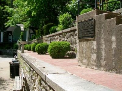
Eureka Springs claims an estimated fifty-six miles of stone walls. Skilled stonemasons constructed most of the walls between 1885 and 1910. The limestone used was sometimes quarried on site but the majority was transported to the town site by horse drawn wagons or railroad flatcars from the quarry near Beaver, six miles away and the railroad junction 2 miles north of Eureka Springs.
In the first census of Eureka Springs in 1880, thirty men gave "stonemason" as their occupation. They were drawn to the new town where construction of dwellings and commercial buildings went on all day and far into the night to keep up with demand. Stonemasons built mainly foundations and retaining walls for the early wood structures. Major fires in 1883 and 1888 brought about a change to stone and brick construction to safeguard against fire.
In 1890, a project to improve and widen the town's main streets and beautify its public places resulted in building many miles of stone walls. This was a massive project as stonemasons constructed walls as much as twenty feet high along Spring, Howell and Main, the Boulevard and other streets. Walls were built on either side of the stream flowing down Main Street and connected by arched stone bridges.
The best known wall builders in Eureka Springs during its first half century were James M. Waldrip and his sons, William, James and John. The Waldrip brothers built miles of walls and created finely crafted stonework to enhance several spring reservations under the directions of the Board of Public Affairs.
Sam A. Leath, Chamber of Commerce Director, devised the estimate of 56 miles of walls about 1948 as a new era of tourism began. Ripley's "Believe It or Not" features in newspapers, radio and television, illustrated the oddities of Eureka Springs more times than any other city, including "136 winding, twisting streets" and "rock walls... miles and miles of them."
Since the 1970 designation of Eureka Springs as a National Register Historic District, more miles of walls have been built in restoration and preservation efforts. Stonemasons as skilled as those who first arrived in Eureka Springs in 1880 continue to create stone walls of great beauty and lasting quality.
Erected by In Partnership with the Greater Eureka Springs Chamber of Commerce, the Community Development Partnership and Cornerstone Builders.
Topics. This historical marker is listed in these topic lists: Architecture • Charity & Public Work • Settlements & Settlers. A significant historical year for this entry is 1885.
Location. 36° 24.134′ N, 93° 44.247′ W. Marker is in Eureka Springs, Arkansas, in Carroll County. Marker is on Spring Street, on the left when traveling north. Marker is in Basin Park. Touch for map. Marker is in this post office area: Eureka Springs AR 72632, United States of America. Touch for directions.
Other nearby markers. At least 8 other markers are within walking distance of this marker. The Springs (here, next to this marker); The Perry House - Basin Park Hotel (within shouting distance of this marker); Spanish-American and World War Veterans Memorial (within shouting distance of this marker); The Basin Park Sycamore (within shouting distance of this marker); The Three Flat-Irons (within shouting distance of this marker); The Southern Hotel (within shouting distance of this marker); Law Offices of F.O. Butt (within shouting distance of this marker); The Basin Bath House (within shouting distance of this marker). Touch for a list and map of all markers in Eureka Springs.
Credits. This page was last revised on September 3, 2020. It was originally submitted on February 14, 2013, by William Fischer, Jr. of Scranton, Pennsylvania. This page has been viewed 837 times since then and 66 times this year. Photos: 1, 2. submitted on February 14, 2013, by William Fischer, Jr. of Scranton, Pennsylvania.

