Union Township near Finleyville in Washington County, Pennsylvania — The American Northeast (Mid-Atlantic)
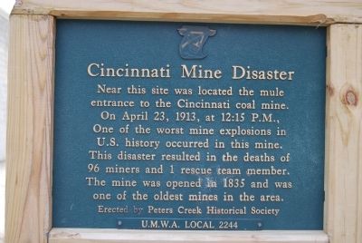
Cincinnati Mine Disaster
Erected by Peters Creek Historical Society and U.M.W.A. Local 224.
Topics. This historical marker is listed in these topic lists: Disasters • Industry & Commerce. A significant historical month for this entry is April 1757.
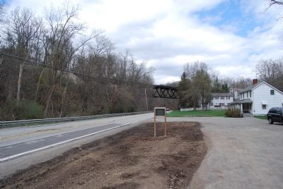
Location. 40° 13.624′ N, 79° 59.648′ W. Marker is near Finleyville, Pennsylvania, in Washington County. It is in Union Township. Marker is on Union Street (Pennsylvania Route 88) 0.2 miles south of Mingo Church Road, on the right when traveling north. Touch for map. Marker is at or near this postal address: 2314 Union Street, Finleyville PA 15332, United States of America. Touch for directions.
Other nearby markers. At least 8 other markers are within 2 miles of this marker, measured as the crow flies. Rev. Saml. Ralston D.D. (approx. 0.2 miles away); Captain James McFarlane (approx. 0.2 miles away); Revolutionary War Soldiers (approx. ¼ mile away); Headstones of American History - The Whiskey Rebellion (approx. ¼ mile away); Mingo Creek Church (approx. ¼ mile away); "Mingo Creek Meeting House" (approx. ¼ mile away); Old Oak Tree Statue (approx. ¼ mile away); Honor Roll (approx. 1.4 miles away). Touch for a list and map of all markers in Finleyville.
Credits. This page was last revised on February 7, 2023. It was originally submitted on April 13, 2013, by Mike Wintermantel of Pittsburgh, Pennsylvania. This page has been viewed 1,017 times since then and 126 times this year. Photos: 1, 2. submitted on April 13, 2013, by Mike Wintermantel of Pittsburgh, Pennsylvania.

