Petaluma in Sonoma County, California — The American West (Pacific Coastal)
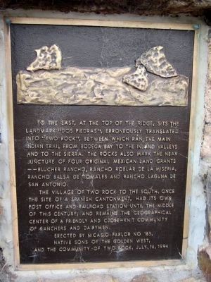
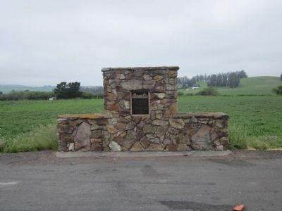
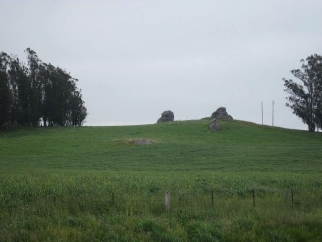
"Dos Piedras"
The village of Two Rock to the south, once the site of a Spanish cantonment, had its own post office and railroad station until the middle of this century; and remains the geographical center of a friendly and close-knit community of ranchers and dairymen.
Note: It should be noted that the “this century” mentioned is now the 20th Century.
Erected 1994 by Nicasio Parlor No.183, Native Sons of the Golden West and the Community of Two Rock.
Topics and series. This historical marker is listed in this topic list: Landmarks. In addition, it is included in the Native Sons/Daughters of the Golden West series list.
Location. 38° 16.266′ N, 122° 47.887′ W. Marker is in Petaluma, California, in Sonoma County. Marker is on Valley Ford Road west of Fallon Road, on the left when traveling north. Touch for map. Marker is at or near this postal address: 7734 Valley Ford Road, Petaluma CA 94952, United States of America. Touch for directions.
Other nearby markers. At least 8 other markers are within 7 miles of this marker, measured as the crow flies. Stormy's (approx. 4.1 miles away); Washoe House (approx. 4˝ miles away); Tomales Town Hall (approx. 6 miles away); Tomales (approx. 6.1 miles away); Veronda/Falletti Ranch (approx. 6.1 miles away); Warren Dutton House - Tomales Community Park (approx. 6.1 miles away); Tomales Presbyterian Church (approx. 6.2 miles away); Cotati Downtown Plaza (approx. 6.3 miles away). Touch for a list and map of all markers in Petaluma.
Also see . . . A Brief History of Two Rock Valley. Dos Piedras goes way back to pre-Spanish days when the rocks served as a landmark and reference point along the ancient Indian trail that ran from Bodega Bay to the inland valleys and into the Sierra. The trails, tend to follow along the ridgelines and high ground because most of the flat land was swampy and muddy. Dos Piedras was referred to time and time again in the earliest annals of Native American migrations and seasonal travels. (Submitted on April 26, 2013.)
Credits. This page was last revised on June 16, 2016. It was originally submitted on April 26, 2013, by Syd Whittle of Mesa, Arizona. This page has been viewed 714 times since then and 35 times this year. Photos: 1, 2, 3. submitted on April 26, 2013, by Syd Whittle of Mesa, Arizona.


