Truchas in Rio Arriba County, New Mexico — The American Mountains (Southwest)
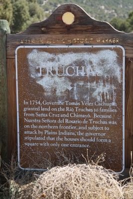
Truchas
Topics. This historical marker is listed in this topic list: Settlements & Settlers. A significant historical year for this entry is 1754.
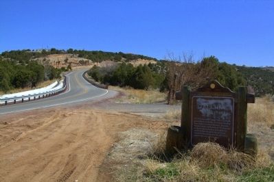
Location. 36° 2.442′ N, 105° 49.803′ W. Marker is in Truchas, New Mexico, in Rio Arriba County. Marker is on State Road 76 near County Road 77A, on the right when traveling east. Touch for map. Marker is in this post office area: Truchas NM 87578, United States of America. Touch for directions.
Other nearby markers. At least 8 other markers are within 13 miles of this marker, measured as the crow flies. Truchas Peaks (approx. 1.3 miles away); Chimayo (approx. 6.2 miles away); Santuario de Chimayó (approx. 6.7 miles away); Las Trampas (approx. 7.4 miles away); Historic Los Luceros (approx. 12 miles away); Velarde (approx. 12.1 miles away); The St. Francis Women's Club (approx. 12.2 miles away); Maria Ramita Simbola Martinez "Summer Harvest" (1884-1969) (approx. 12.3 miles away).
Also see . . . Wikipedia Entry. “The community remains remote, located at 8000 feet above sea level. A paved road did not enter the community till the early 1970s. These very same issues made the community attractive to artists moving to Northern New Mexico for its thriving arts scene, particularly after Robert Redford’s ,The Milagro Beanfield War (1988) was filmed there. The arrival of the artist has altered the traditional pace of agricultural life among the original Spanish settlers, at times leading to tensions, which have more recently receded. There are also a number of vacation and second homes in the village and in the surrounding area. Because the community had remained unchanged for so long, it still operates under many of the original Spanish land grant bylaws; for example, cars must share the roads with livestock.” (Submitted on April 30, 2013.)
Credits. This page was last revised on June 16, 2016. It was originally submitted on April 30, 2013, by J. J. Prats of Powell, Ohio. This page has been viewed 618 times since then and 39 times this year. Photos: 1, 2, 3. submitted on April 30, 2013, by J. J. Prats of Powell, Ohio.
Editor’s want-list for this marker. Photos of the village and the church. • Can you help?


