Sumterville in Sumter County, Florida — The American South (South Atlantic)
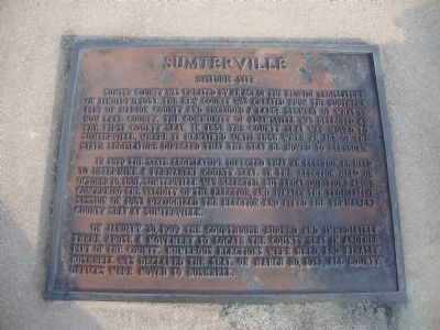
Sumterville
Historic Site
In 1879 the state legislature directed that an election be held to determine a permanent county seat. In the election held on October 10, 1881, Sumterville was selected, but legal questions arose concerning the validity of the election and finally the legislative session on 1883 recognized the election and fixed the permanent county seat as Sumterville.
On January 30, 1909 the courthouse burned and immediately there arose a movement to locate the county seat in another part of the county. Numerous elections were held, and finally Bushnell was declared the seat on March 20, 1912, all county offices were moved to Bushnell.
Topics. This historical marker is listed in this topic list: Settlements & Settlers. A significant historical month for this entry is January 1942.
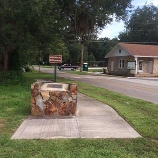
Location. 28° 44.662′ N, 82° 3.842′ W. Marker is in Sumterville, Florida, in Sumter County. Marker is at the intersection of U.S. 301 and County Road 522, on the right when traveling north on U.S. 301. Touch for map. Marker is in this post office area: Sumterville FL 33585, United States of America. Touch for directions.
Other nearby markers. At least 8 other markers are within 9 miles of this marker, measured as the crow flies. Adamsville (approx. 4.6 miles away); Pilaklikaha/Abraham's Town (approx. 5˝ miles away); Bushnell Veterans Memorial (approx. 6.2 miles away); Ft. Armstrong (approx. 7.1 miles away); Baker House (approx. 7.4 miles away); On This Spot (approx. 7˝ miles away); Bank of Wildwood (approx. 8.3 miles away); Sumter County Farmers Market (approx. 8.9 miles away).
Credits. This page was last revised on July 22, 2018. It was originally submitted on July 23, 2013, by Tim Fillmon of Webster, Florida. This page has been viewed 888 times since then and 39 times this year. Photos: 1. submitted on July 23, 2013, by Tim Fillmon of Webster, Florida. 2. submitted on September 25, 2014, by James R. Murray of Elkton, Florida. • Bill Pfingsten was the editor who published this page.

