Lyndhurst in Bergen County, New Jersey — The American Northeast (Mid-Atlantic)
River Road School
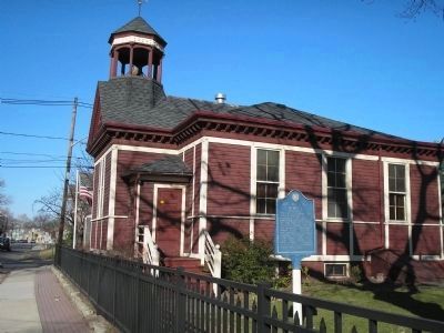
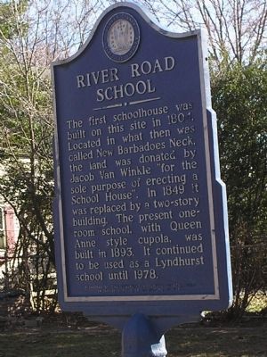
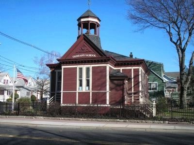
The first schoolhouse was built on this site in 1804. Located in what then was called New Barbadoes Neck, the land was donated by Jacob Van Winkle “for the sole purpose of erecting a School House”. In 1849 it was replaced by a two-story building. The present one-room school, with Queen Anne style cupola, was built in 1893. It continued to be used as a Lyndhurst school until 1978.
Sponsored by the Lyndhurst Historical Society
In National Register of Historic Places
Erected 1984 by Bergen County Historical Society. (Marker Number 88.)
Topics and series. This historical marker is listed in these topic lists: Architecture • Education. In addition, it is included in the New Jersey, Bergen County Historical Society series list. A significant historical year for this entry is 1804.
Location. 40° 48.879′ N, 74° 8.05′ W. Marker is in Lyndhurst, New Jersey, in Bergen County. Marker is at the intersection of Riverside Ave and Fern Ave, on the right when traveling north on Riverside Ave. Touch for map. Marker is at or near this postal address: 400 Riverside Ave, Lyndhurst NJ 07071, United States of America. Touch for directions.
Other nearby markers. At least 8 other markers are within 2 miles of this marker, measured as the crow flies. A different marker also named River Road School (within shouting distance of this marker); Operations Desert Storm and Iraqi Freedom (approx. half a mile away); Lyndhurst War Memorial (approx. half a mile away); The Passaic River (approx. 0.8 miles away); John McGarry (approx. 0.9 miles away); Kingsland Manor (approx. 0.9 miles away); Vreeland House (approx. 1.3 miles away); John F. Kennedy (approx. 1.3 miles away). Touch for a list and map of all markers in Lyndhurst.
Also see . . .
1. River Road School. Lyndhurst Historical Society (Submitted on March 29, 2008, by Bill Coughlin of Woodland Park, New Jersey.)
2. BCHS Historic Marker Porgram. Society website entry (Submitted on March 29, 2008, by Kevin W. of Stafford, Virginia.)

Photographed By Bill Coughlin, March 29, 2008
2. Marker and the Schoolhouse
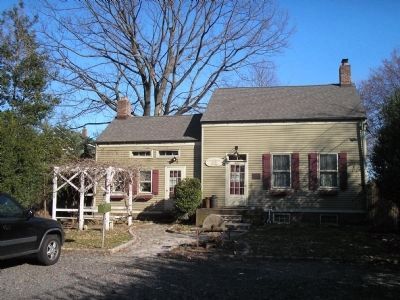
On this site, in 1804, was born the first known public school system of Bergen County, NJ deeded to the school trustees of what was then called New Barbadoes Neck. This property given for the sole purpose of erecting a school was to yield and pay the yearly rent of one peppercorn if demanded.
Credits. This page was last revised on December 10, 2021. It was originally submitted on March 29, 2008, by Bill Coughlin of Woodland Park, New Jersey. This page has been viewed 2,092 times since then and 25 times this year. Photos: 1, 2, 3, 4. submitted on March 29, 2008, by Bill Coughlin of Woodland Park, New Jersey. • Kevin W. was the editor who published this page.


