Vallecito in Calaveras County, California — The American West (Pacific Coastal)
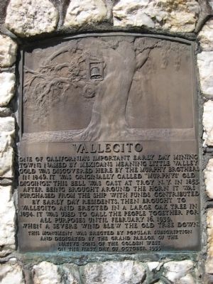
Vallecito
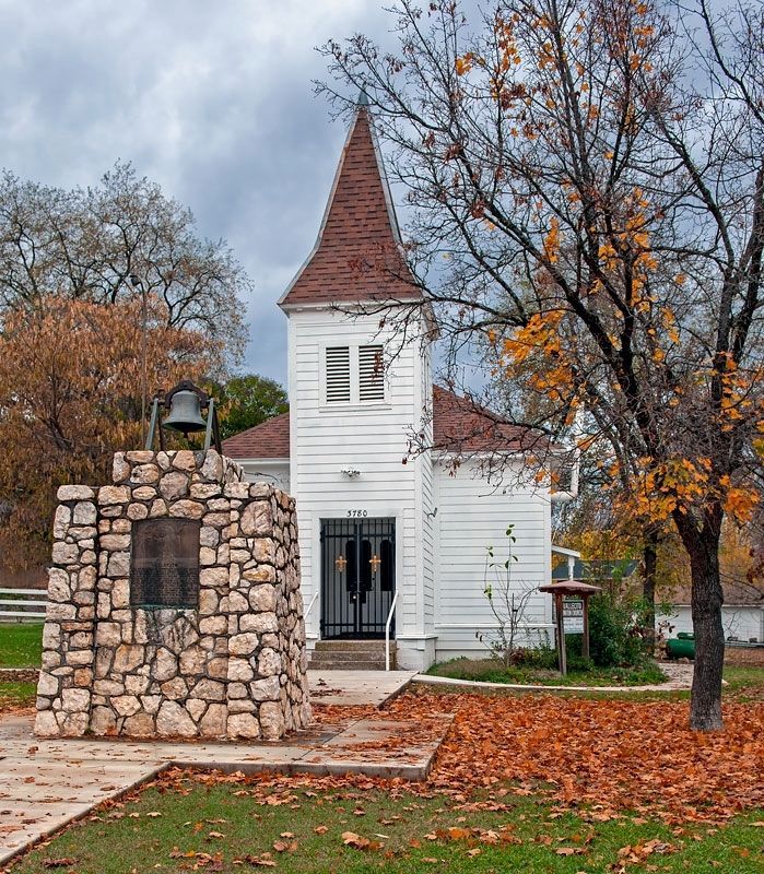
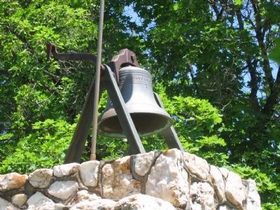
One of California's important early day mining towns named by Mexicans meaning Little Valley. Gold was discovered here by the Murphy Brothers on 1849. It was originally called "Murphys' Old Diggings". This bell was cast at Troy N.Y. in 1853. After being brought around the horn it was purchased from the ship with funds contributed by early day residents, then brought to Vallecito and erected in a large oak tree in 1854. It was used to call the people together for all purposes until February 16, 1939, when a severe wind blew the old tree down.
Erected 1939 by popular subscription and dedicated by the Grand Parlor of the Native Sons of the Golden West. (Marker Number 370.)
Topics and series. This historical marker is listed in these topic lists: Notable Places • Settlements & Settlers. In addition, it is included in the California Historical Landmarks, and the Native Sons/Daughters of the Golden West series lists. A significant historical date for this entry is February 16, 1787.
Location. 38° 5.182′ N, 120° 28.448′ W. Marker is in Vallecito, California, in Calaveras County. Marker is at the intersection of Church Street and Cemetary Lane, on the left when traveling north on Church Street. Touch for map. Marker is in this post office area: Vallecito CA 95251, United States of America. Touch for directions.
Other nearby markers. At least 8 other markers are within 4 miles of this marker, measured as the crow flies. Dinkelspiel Store (about 500 feet away, measured in a direct line); Camp Nine Bell (approx. 0.2 miles away); The Italian Store (approx. 2.3 miles away); Joseph Schachten (approx. 3.3 miles away); Parrott’s Ferry (approx. 3.4 miles away); Site of Brownsville (approx. 3.4 miles away); Ebbetts Pass Veterans Memorial (approx. 3˝ miles away); The Murphys Pokey (approx. 3˝ miles away). Touch for a list and map of all markers in Vallecito.
Regarding Vallecito.
In 1940 this was designated California Historical Landmark No. 370 - Vallecito Bell Monument.
In 1937 this area was designated California Historical Landmark No. 273 - Vallecito. “This mining camp of the early 1850s was almost totally destroyed by fire on August 28, 1859. Nearby is Moaning Cave, which the Indians used as a burial ground.”
Also see . . .
1. Significant Towns of the Mother Lode Country. Vallecito is briefly mentioned here in this chapter from the book A Guide to the Mother Lode Country (1948) by C. Frank Brockman. A picture of this marker taken at that time is included. (Submitted on April 7, 2008, by Matt Gholson of Houston, Texas.)
2. The bell of Vallecito: a historical mystery - Stolen or bought? Only the dead know for sure. The Calaveras Enterprise (12/4/2015) looks at various sources and considers whether the bell was stolen or bought, and whether it had originally been a ship's bell. (Submitted on December 4, 2015.)
Credits. This page was last revised on January 28, 2024. It was originally submitted on April 2, 2008, by Richard Wisehart of Sonora, California. This page has been viewed 2,236 times since then and 23 times this year. Photos: 1. submitted on April 2, 2008, by Richard Wisehart of Sonora, California. 2. submitted on January 5, 2021, by Alvis Hendley of San Francisco, California. 3. submitted on April 2, 2008, by Richard Wisehart of Sonora, California. 4. submitted on August 13, 2008, by Syd Whittle of Mesa, Arizona. • Kevin W. was the editor who published this page.


