Fort Mason in San Francisco City and County, California — The American West (Pacific Coastal)
San Francisco Port of Embarkation
Army’s primary depot for Pacific operation
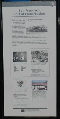
First garrisoned by U.S. Army troops during the Civil War, Fort Mason later played a key role in the emergence of the United States as an international power. Throughout the 1800s, the young country’s military resources were focused on subduing Native Americans and supporting the nation’s expansion across the continent. Beginning with the Spanish-American War in 1898, the focus shifted overseas. Between 1909 and 1914, the army developed Fort Mason to support U.S. interests in the Pacific.
Fully operational by 1915, and known as the San Francisco Port of Embarkation since 1932, the Fort Mason depot operated until 1962. In the 1970s, the long-vacant buildings were rehabilitated and today look much as they did when they were first constructed.
Center Side Bar:
Pacific locations to which troops and supplies were shipped from the Port of Embarkation:
Hawaii • Guam • Philippines • Alaska • Aleutian Islands • China • Panama Canal • Guadalcanal • Japan • Korea.
During World War II, the San Francisco Port of Embarkation experienced explosive growth. The numbers only begin to tell the story.
In 1939
Employed 831 people
Shipped 48,000 tons of cargo
By the end of the war in 1948
Employed more than 30,000 people
Shipped 23.6 million tons of cargo and 1.65 million soldiers.
Look about today and you'll see remnants of the historic train tracks seen in this photo.
Bottom Side Bar
Military Architecture
On U.S. Army posts around the world, the Quartermaster Corps once managed living quarters, supplies, and transportation, among other duties. The quartermaster insignia symbolizes these responsibilities:
• eagle represents the nation
• sword signifies the military forces
• key signifies the Corps’ storekeeping function
• wheel (styled after a six-mule-wagon wheel) represents transportation
• wheel’s thirteen spokes and stars represents the original thirteen colonies and the Corp’s origin during the Revolutionary War.
Look for the Quartermaster insignia on Fort Mason’s historic pier buildings.
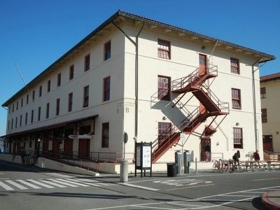
As the army’s role extended abroad, military planners turned to local influences for the new depot facility. They looked to the southwest’s Spanish Colonial missions for inspiration and chose Mission Revival-style architecture for Fort Mason’s warehouses. Eventually the Mission revival style would be so closely associated with the West Coast military architecture that red-tiled roofs and unadorned white walls would indicate military presence.
Erected by Golden Gate National Recreation Area.
Topics. This historical marker is listed in these topic lists: Forts and Castles
• Military • War, World II. A significant historical year for this entry is 1898.
Location. Marker is missing. It was located near 37° 48.388′ N, 122° 25.913′ W. Marker was in San Francisco, California, in San Francisco City and County. It was in Fort Mason. Marker could be reached from Marina Boulevard. Touch for map. Marker was at or near this postal address: 100 Marina Boulevard, San Francisco CA 94123, United States of America. Touch for directions.
Other nearby markers. At least 8 other markers are within walking distance of this location. Fort Mason Historic District (about 500 feet away, measured in a direct line); a different marker also named Fort Mason Historic District (about 600 feet away); Brigantine Galilee (about 600 feet away); a different marker also named San Francisco Port of Embarkation (approx. 0.2 miles away); Phillip Burton (approx. 0.2 miles away); Golden Gate National Recreation Area Legislation (approx. 0.2 miles away); San Francisco Port of Embarkation (1932-1962) (approx. 0.2 miles away); a different marker also named Fort Mason Historic District (approx. 0.3 miles away). Touch for a list and map of all markers in San Francisco.
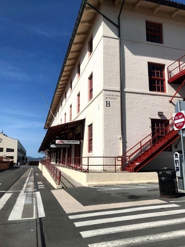
More about this marker. This markers is in the lower Fort Mason parking lot in front of Building B.
Credits. This page was last revised on February 7, 2023. It was originally submitted on November 6, 2013, by Barry Swackhamer of Brentwood, California. This page has been viewed 694 times since then and 45 times this year. Photos: 1, 2. submitted on November 6, 2013, by Barry Swackhamer of Brentwood, California. 3. submitted on April 7, 2021, by Diane Phillips of Pittsburg, California. • Syd Whittle was the editor who published this page.


