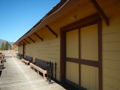
Yreka in Siskiyou County, California — The American West (Pacific Coastal)
Yreka Western
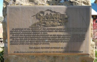
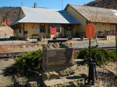
In 1933 the railroad was incorporated as the Yreka Western Railroad. 1935 brought hard times which were overcome under the direction of O.G. Steele.
In 1986 the City of Yreka commenced the summer excursion train known as the Blue Goose and today Yreka Western continues to operate as a working railroad after over 100 years of service.
By the Humbug Chapter of E Clampus Vitus and the Siskiyou Historical Society
Erected 1990 by E Clampus Vitus, Humbug Chapter 73 & Siskiyou County Historical Societ.
Topics and series. This historical marker is listed in this topic list: Railroads & Streetcars. In addition, it is included in the E Clampus Vitus series list. A significant historical date for this entry is January 9, 1889.
Location. 41° 43.807′ N, 122° 37.876′ W. Marker is in Yreka, California, in Siskiyou County. Marker is on East Center Street, on the right when traveling east. Touch for map. Marker is at or near this postal address: 370 East Center Street, Yreka CA 96097, United States of America. Touch for directions.
Other nearby markers. At least 8 other markers are within walking distance of this marker. The Greathouse/DeWitt Building (approx. ¼ mile away); Site of Yreka Inn / Site of Dr. Daniel Ream Ranch (approx. ¼ mile away); I.O.O.F. Building (approx. ¼ mile away); The Riddle Building (approx. ¼ mile away); Gas Works (approx. ¼ mile away); Nicholas T. Delean Building (approx. 0.3 miles away); 200, 202 W. Miner St. (approx. 0.3 miles away); 204 W. Miner St. (approx. 0.3 miles away). Touch for a list and map of all markers in Yreka.
Credits. This page was last revised on June 16, 2016. It was originally submitted on November 13, 2013, by Barry Swackhamer of Brentwood, California. This page has been viewed 426 times since then and 19 times this year. Photos: 1, 2, 3, 4. submitted on November 13, 2013, by Barry Swackhamer of Brentwood, California. 5. submitted on November 14, 2013, by Barry Swackhamer of Brentwood, California. • Al Wolf was the editor who published this page.
