Hornbrook in Siskiyou County, California — The American West (Pacific Coastal)
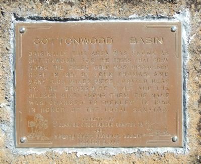
Cottonwood Basin
Dedicated by
E Clampus Vitus Humbug Chapter 73
and
Siskiyou County Historical Society
December 5, 1992
Erected 1992 by E Clampus Vitus, Humbug Chapter 73 & Siskiyou County Historical Society.
Topics and series. This historical marker is listed in this topic list: Settlements & Settlers. In addition, it is included in the E Clampus Vitus series list. A significant historical month for this entry is December 1883.
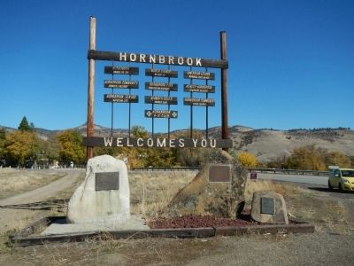
Location. 41° 54.088′ N, 122° 33.804′ W. Marker is in Hornbrook, California, in Siskiyou County. Marker is at the intersection of Copco Road and Oregon Road, on the left when traveling west on Copco Road. Touch for map. Marker is at or near this postal address: 103 Copco Road, Hornbrook CA 96044, United States of America. Touch for directions.
Other nearby markers. At least 8 other markers are within 8 miles of this marker, measured as the crow flies. Bradford Ripley Alden (here, next to this marker); Cottonwood (approx. 0.3 miles away); Founding of the American Legion (approx. 0.7 miles away); Klamathon (approx. 2.8 miles away); All Roads Lead to Ager Stage and Freight Stop (approx. 5.8 miles away); Pioneer Stage Drivers (approx. 6.6 miles away); Hilt, CA (approx. 7.2 miles away); Hilt War Memorial (approx. 7.2 miles away). Touch for a list and map of all markers in Hornbrook.
Credits. This page was last revised on June 16, 2016. It was originally submitted on November 14, 2013, by Barry Swackhamer of Brentwood, California. This page has been viewed 556 times since then and 30 times this year. Photos: 1, 2. submitted on November 14, 2013, by Barry Swackhamer of Brentwood, California. • Al Wolf was the editor who published this page.

