Oldenburg in Fayette County, Texas — The American South (West South Central)
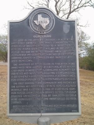
Oldenburg
The majority of the settlers in this area were immigrants from Germany and Bohemia. At its height Oldenburg boasted homes, farms, and a number of businesses and institutions, including stores, saloons, a cotton gin, tin shop, doctors' office, blacksmith shop, post office, church, dance halls (festplatz), and schools.
The first school in the community was known as the German and Bohemian Oldenburg School. Founded in 1898, it was succeeded in 1922 by Oldenburg Common School District No. 5. A separate school for black students opened about 1930. By 1944, both schools were consolidated with the Fayetteville School District.
Descendants of early German and Bohemian settlers continue to reside in this vicinity.
Erected 1990 by Texas Historical Commission. (Marker Number 3838.)
Topics. This historical marker is listed in this topic list: Settlements & Settlers. A significant historical year for this entry is 1838.
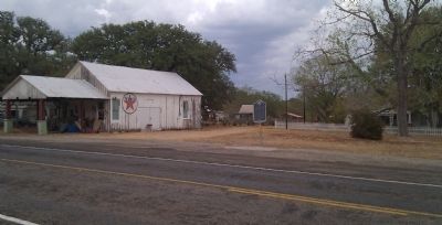
Location. 29° 58.536′ N, 96° 45.97′ W. Marker is in Oldenburg, Texas, in Fayette County. Marker is on State Highway 237, 0.9 miles north of State Highway 159, on the right when traveling north. Touch for map. Marker is in this post office area: Round Top TX 78954, United States of America. Touch for directions.
Other nearby markers. At least 8 other markers are within 6 miles of this marker, measured as the crow flies. Asa Hill of Rutersville (approx. 2.8 miles away); Rutersville (approx. 2.8 miles away); Rutersville College (approx. 2.9 miles away); Site of First Methodist Annual Conference in Texas (approx. 2.9 miles away); a different marker also named Rutersville College (approx. 2.9 miles away); Halamicek Cemetery (approx. 4.8 miles away); Waldeck Cemetery (approx. 5.8 miles away); Waldeck Evangelical Lutheran Church (approx. 6.1 miles away).
Also see . . . Oldenburg, TX, article in the Handbook of Texas. (Submitted on February 3, 2014, by Gregory Walker of La Grange, Texas.)
Credits. This page was last revised on June 16, 2016. It was originally submitted on February 3, 2014, by Gregory Walker of La Grange, Texas. This page has been viewed 702 times since then and 66 times this year. Photos: 1, 2. submitted on February 3, 2014, by Gregory Walker of La Grange, Texas. • Bernard Fisher was the editor who published this page.

