Atlas District in Northeast Washington in Washington, District of Columbia — The American Northeast (Mid-Atlantic)
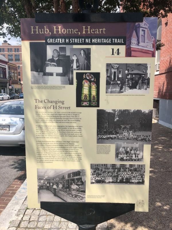
The Changing Faces of H Street
Hub, Home, Heart
— Greater H Street NE Heritage Trail —
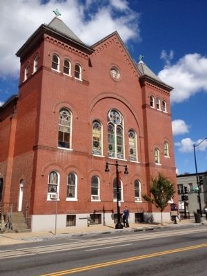
The handsome church on this corner is the second to occupy this spot. The first was a small brick chapel built by John A. Douglas in 1878 for the new Memorial Methodist Episcopal Church. Soon after, it was renamed Douglas Memorial Methodist Episcopal Church to honor its builder and his wife Sidney, who donated the land. The current building replaced it in 1898 as the block filled with brick houses and stores.
Douglas Memorial served a white congregation. But beginning in the 1940s, its members moved away, and the parish dwindled. In 1958 the governing Baltimore Conference assigned a young African American pastor, Forrest C. Stith, to rebuild the congregation. By knocking on doors and reaching out to youth, Stith increased the church's membership from nearly zero to 200 in three years. On 11th Street between I and K, Holy Name Catholic Church experienced the same racial makover.
As these church histories show, well before "white flight" transformed American cities in the 1950s, the face of H Street was changing. Descendants of European immigrant families, thanks to public school education, moved into better-paying professions and newer neighborhoods. African Americans had become a majority in Greater H Street by 1950. In response the DC School Board switched the white Franklin Pierce Elementary on Maryland Avenue, and other neighborhood schools, to the "colored" division. The Supreme Court's 1954 desegregation of the nation's schools accelerated white flight to exclusive suburbs. For decades, in a very divided city, Greater H Street was almost entirely African American. As the 21st century opened, though, it followed the city's trend towards a more racially diverse population.
Erected 2012 by Cultural Tourism DC. (Marker Number 14.)
Topics and series. This historical marker is listed in these topic lists: African Americans • Churches & Religion • Notable Places. In addition, it is included in the Greater H Street Heritage Trail series list. A significant historical year for this entry is 1878.
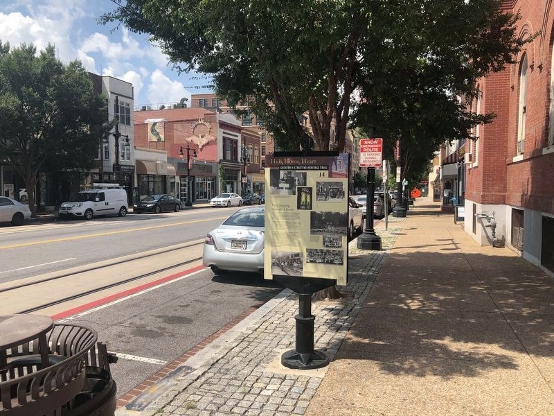
Location. 38° 54.018′ N, 76° 59.5′ W. Marker is in Northeast Washington in Washington, District of Columbia. It is in the Atlas District. Marker is at the intersection of H Street Northeast and 11th Street Northeast, on the right when traveling west on H Street Northeast. Touch for map. Marker is at or near this postal address: 1033 H Street Northeast, Washington DC 20002, United States of America. Touch for directions.
Other nearby markers. At least 8 other markers are within walking distance of this marker. Life on H Street (within shouting distance of this marker); Henrietta Vinton Davis Residence (about 700 feet away, measured in a direct line); Dr. Granville N. Moore (about 800 feet away); Enterprising Families
![The Changing Faces of H Street Marker [Reverse]. Click for full size. The Changing Faces of H Street Marker [Reverse] image. Click for full size.](Photos5/534/Photo534167.jpg?89202033700PM)
Photographed By Devry Becker Jones (CC0), August 9, 2020
2. The Changing Faces of H Street Marker [Reverse]
Related markers. Click here for a list of markers that are related to this marker. Greater H Street NE Heritage Trail
Credits. This page was last revised on January 30, 2023. It was originally submitted on October 7, 2012, by Craig Swain of Leesburg, Virginia. This page has been viewed 750 times since then and 82 times this year. Last updated on February 11, 2014, by A. Taylor of Laurel, Maryland. Photos: 1, 2, 3. submitted on August 9, 2020, by Devry Becker Jones of Washington, District of Columbia. 4. submitted on October 7, 2012, by Craig Swain of Leesburg, Virginia. • Bill Pfingsten was the editor who published this page.


