Lanham in Prince George's County, Maryland — The American Northeast (Mid-Atlantic)
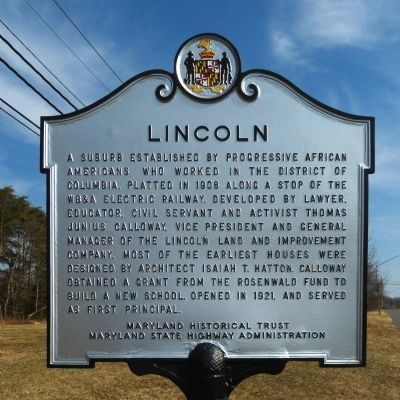
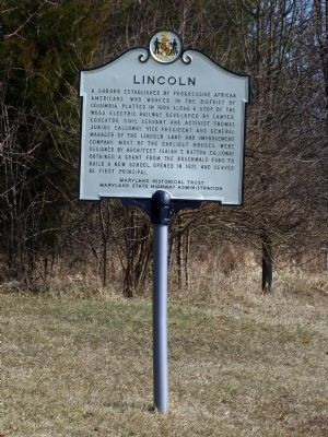
Lincoln
Erected by Maryland Historical Trust, Maryland State Highway Administration.
Topics and series. This historical marker is listed in this topic list: Settlements & Settlers. In addition, it is included in the Rosenwald Schools series list. A significant historical year for this entry is 1908.
Location. 38° 57.523′ N, 76° 49.565′ W. Marker is in Lanham, Maryland, in Prince George's County. Marker is at the intersection of Annapolis Road (Maryland Route 450) and Baltimore Lane when traveling south on Annapolis Road. Touch for map. Marker is at or near this postal address: 5001 Baltimore Lane, Lanham MD 20706, United States of America. Touch for directions.
Other nearby markers. At least 8 other markers are within 3 miles of this marker, measured as the crow flies. Marietta (approx. 1.6 miles away); Moon Tree (approx. 2.6 miles away); Apollo In Your Life / The Future Lunar Program (approx. 2.6 miles away); Duties (approx. 2.6 miles away); Life Onboard (approx. 2.6 miles away); Apollo Command Module (approx. 2.6 miles away); Nike-Black Brant (approx. 2.6 miles away); Polar Robotic Ranger (approx. 2.6 miles away).
Also see . . .
1. Lincoln Survey District. (PDF) Maryland Inventory of Historic Places (Submitted on March 2, 2014, by Allen C. Browne of Silver Spring, Maryland.)
2. Lincoln. African American Historic and Cultural Resources in Prince George's County Maryland. (Submitted on March 2, 2014, by Allen C. Browne of Silver Spring, Maryland.)
Credits. This page was last revised on January 9, 2022. It was originally submitted on March 2, 2014, by Allen C. Browne of Silver Spring, Maryland. This page has been viewed 561 times since then and 34 times this year. Photos: 1, 2, 3, 4, 5. submitted on March 2, 2014, by Allen C. Browne of Silver Spring, Maryland. • Bill Pfingsten was the editor who published this page.
