Marker Logo HMdb.org THE HISTORICAL
MARKER DATABASE
“Bite-Size Bits of Local, National, and Global History”
Vauxhall in Millburn in Essex County, New Jersey — The American Northeast (Mid-Atlantic)
 

Battle of Springfield


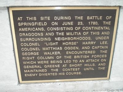
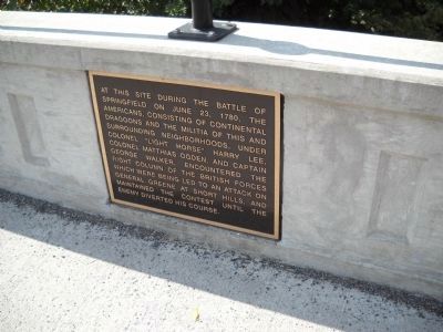
Battle of Springfield Marker image. Click for full size.
Photographed By Bill Coughlin, April 26, 2008
1. Battle of Springfield Marker
Inscription. At this site during the Battle of Springfield on June 23, 1780, the Americans, consisting of Continental Dragoons and the militia of this and surrounding neighborhoods, under Colonel “Light Horse” Harry Lee, Colonel Matthias Ogden, and Captain George Walker, encountered the right column of the British forces which were being led to an attack on General Greene at Short Hills, and maintained the contest until the enemy diverted his course.
 
Topics. This historical marker is listed in this topic list: War, US Revolutionary. A significant historical month for this entry is June 1882.
 
Location. 40° 43.276′ N, 74° 17.427′ W. Marker is in Millburn, New Jersey, in Essex County. It is in Vauxhall. Marker is on Vauxhall Road (County Route 630), on the left when traveling north. Marker is on the Vauxhall Road over the Rahway River. Touch for map. Marker is in this post office area: Millburn NJ 07041, United States of America. Touch for directions.
 
Other nearby markers. At least 8 other markers are within one mile of this marker, measured as the crow flies. American Delaying Action (within shouting distance of this marker); First Meeting of the Wyoming Presbyterian Church (approx. 0.4 miles away); Washington Rock (approx. ¾ mile away); General Sir Henry Clinton (approx. 0.9 miles away); Last British Thrust into New Jersey (approx. one mile away); James Ricalton
Paid Advertisement
Click on the ad for more information.
Please report objectionable advertising to the Editor.
Click or scan to see
this page online
(approx. one mile away); Paper Mill Playhouse (approx. 1.1 miles away); Angelo Del Rossi (approx. 1.1 miles away). Touch for a list and map of all markers in Millburn.
 
Also see . . .  The Battles of Connecticut Farms and Springfield. (Submitted on April 26, 2008, by Bill Coughlin of Woodland Park, New Jersey.)
 
Battle of Springfield Marker image. Click for full size.
Photographed By Bill Coughlin, September 25, 2010
2. Battle of Springfield Marker
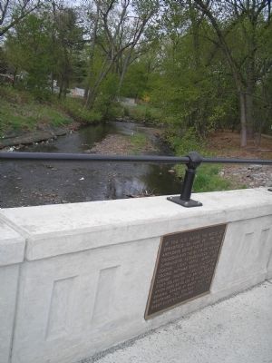
Marker on Little's Bridge image. Click for full size.
Photographed By Bill Coughlin, April 26, 2008
3. Marker on Little's Bridge
The Americans met the British and Hessian army under Knyphausen as they crossed the Rahway River here on June 23, 1780 during the Battle of Springfield.
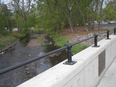
Little's Bridge Marker image. Click for full size.
Photographed By Bill Coughlin, April 26, 2008
4. Little's Bridge Marker
Marker is located on the bridge that spans the Rahway River in Millburn.
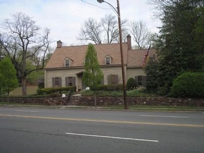
The Hessian House - circa 1730 image. Click for full size.
Photographed By Bill Coughlin, April 26, 2008
5. The Hessian House - circa 1730
This house, one of only four not burned by the retreating British, is located near the marker. According to legend, a pair of Hessian deserters hid here during the Battle of Springfield.
 
 
Credits. This page was last revised on February 16, 2023. It was originally submitted on April 26, 2008, by Bill Coughlin of Woodland Park, New Jersey. This page has been viewed 1,418 times since then and 14 times this year. Photos:   1. submitted on April 26, 2008, by Bill Coughlin of Woodland Park, New Jersey.   2. submitted on September 25, 2010, by Bill Coughlin of Woodland Park, New Jersey.   3, 4, 5. submitted on April 26, 2008, by Bill Coughlin of Woodland Park, New Jersey. • Craig Swain was the editor who published this page.
Share this page.  
Share on Tumblr
m=7358

CeraNet Cloud Computing sponsors the Historical Marker Database.
This website earns income from purchases you make after using our links to Amazon.com. We appreciate your support.
Paid Advertisements
Mar. 19, 2024