Medora in Jackson County, Indiana — The American Midwest (Great Lakes)
Medora Shale Brick Plant
(Side One)
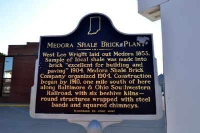
West Lee Wright laid out Medora 1853. Sample of local shale was made into brick “excellent for building and paving” 1904. Medora Shale Brick Company organized 1904. Construction began by 1910, one south of here along Baltimore & Ohio Southwestern Railroad, with six beehive kilns—round structures wrapped with steel bands and squared chimneys.
(Side Two)
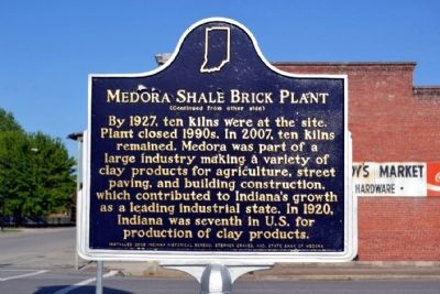
By 1927, ten kilns were at the site. Plant closed 1990s. In 1007, ten kilns remained. Medora was part of a large industry making a variety of clay products for agriculture, street paving, and building construction, which contributed to Indiana’s growth as a leading industrial state. In 1920, Indiana was seventh in U.S. for production of clay products.
Erected 2008 by Indiana Historical Bureau, Stephen Graves, and State Bank of Medora. (Marker Number 36.2008.1.)
Topics and series. This historical marker is listed in these topic lists: Industry & Commerce • Settlements & Settlers. In addition, it is included in the Indiana Historical Bureau Markers series list. A significant historical year for this entry is 1853.
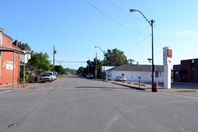
Location. 38° 49.518′ N, 86° 10.205′ W. Marker is in Medora, Indiana, in Jackson County. Marker is at the intersection of Perry Street (State Road 235) and Main Street, on the right when traveling north on Perry Street. Touch for map. Marker is in this post office area: Medora IN 47260, United States of America. Touch for directions.
Other nearby markers. At least 8 other markers are within 8 miles of this marker, measured as the crow flies. Medora Covered Bridge (approx. 1.3 miles away); Bartholomew Trail (approx. 4.1 miles away); Site of Fort Vallonia (approx. 4.1 miles away); Driftwood Church and Cemetery (approx. 4.2 miles away); Fort Vallonia (approx. 4.6 miles away); In Memory of Col. John Ketcham / Time Capsule (approx. 7.8 miles away); All Veterans Honor Roll Memorial (approx. 7.8 miles away); The Freedom Tree (approx. 7.8 miles away).
Also see . . .
1. IHB Annotations. The Indiana Historical Bureau provides annotations for the text of the marker on their website. (Submitted on June 3, 2014.)
2. Medora Brick Plant Site. Comprehensive website with a history of the site and yesteryear and present photographs. (Submitted on June 3, 2014.)
Credits. This page was last revised on June 16, 2016. It was originally submitted on June 3, 2014, by Duane Hall of Abilene, Texas. This page has been viewed 461 times since then and 23 times this year. Photos: 1, 2, 3, 4. submitted on June 3, 2014, by Duane Hall of Abilene, Texas.


