Barnet in Caledonia County, Vermont — The American Northeast (New England)
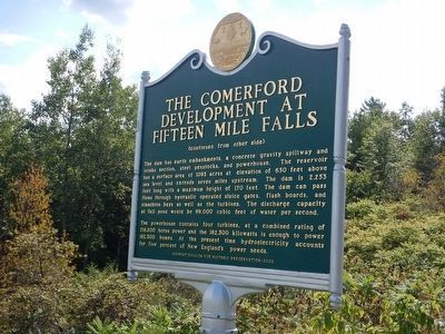
The Comerford Development at Fifteen Mile Falls
Inscription.
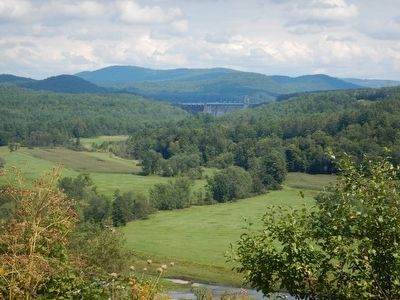
The Connecticut River, starting at the International Boundary, flows 380 miles to the Atlantic Ocean. In its course the river falls 1640 feet. In 1928, the New England Power Association started a two-year project to build one of the largest hydro-electric developments in the country. The dam is located in the towns of Monroe, NH and Barnet, VT and is 275 miles above the river's mouth. When dedicated on September 30, 1930 President Herbert Hoover pressed a button at the White House to start the first of four generating units.
This marker commemorates 75 years of continual operation of this project and is dedicated to the builders, operators and neighbors of this first Fifteen Mile Falls Development.
The dam has earth embankments, a concrete gravity spillway and intake section, steel penstocks, and powerhouse. The reservoir has a surface area of 1093 acres at elevation of 650 feet above sea level and extends seven miles upstream. The dam is 2,253 feet long with a maximum height of 170 feet. The dam can pass flows through hydraulic operated sluice gates, flash boards, and stanchion bays as well as the turbines. The discharge capacity at full pond would be 99,000 cubic feet of water per second.
The powerhouse contains four turbines, at a combined rating of 216,800 horse power and the 162,300 kilowatts is enough to power 162,300 homes. At the present time hydroelectricity accounts for five percent of New England's power needs.
Erected 2006 by Vermont Division for Historic Preservation.
Topics and series. This historical marker is listed in this topic list: Industry & Commerce. In addition, it is included in the Former U.S. Presidents: #31 Herbert Hoover series list. A significant historical date for this entry is September 30, 1930.
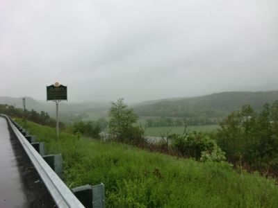
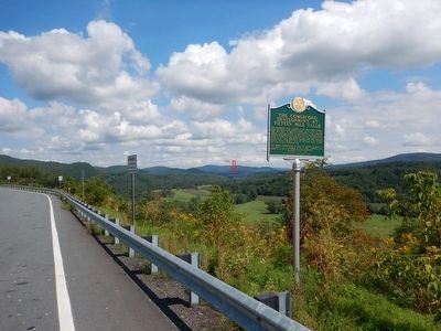
Location. 44° 18.483′ N, 72° 2.117′ W. Marker is in Barnet, Vermont, in Caledonia County. Marker is on Interstate 91 at milepost 121.8, on the right when traveling north. The marker is located at the scenic turnout (no services) at milemarker 121.8 of I-91 northbound. Touch for map. Marker is in this post office area: Barnet VT 05821, United States of America. Touch for directions.
Other nearby markers. At least 8 other markers are within 8 miles of this marker, measured as the crow flies. Henry Stevens / Henry Stevens, Jr. (approx. one mile away); Moore Round Barn (approx. 2˝ miles away); Ben's Mill (approx. 3.1 miles away); Passumpsic Veterans Memorial (approx. 4.7 miles away); Greenbank's Hollow (approx. 6.4 miles away); Site of Camp Baxter (approx. 6.7 miles away); Caledonia County Grammar School (approx. 6.8 miles away); James Whitehill Stone House (approx. 7.4 miles away). Touch for a list and map of all markers in Barnet.
Credits. This page was last revised on July 31, 2020. It was originally submitted on June 10, 2013, by Don Morfe of Baltimore, Maryland. This page has been viewed 935 times since then and 40 times this year. Last updated on June 16, 2014, by Kevin Craft of Bedford, Quebec. Photos: 1. submitted on June 10, 2013, by Don Morfe of Baltimore, Maryland. 2. submitted on August 29, 2015, by Kevin Craft of Bedford, Quebec. 3. submitted on June 10, 2013, by Don Morfe of Baltimore, Maryland. 4, 5. submitted on August 31, 2015, by Kevin Craft of Bedford, Quebec. • Bill Pfingsten was the editor who published this page.


