Saint-Jean-sur-Richelieu in Le Haut-Richelieu, Québec — Central Canada (French-Canadian)
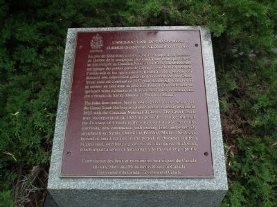
Former Grand Trunk Railway Station
Erected by Historic Sites and Monument Board of Canada.
Topics and series. This historical marker is listed in this topic list: Railroads & Streetcars. In addition, it is included in the Canada, Historic Sites and Monuments Board series list. A significant historical year for this entry is 1890.
Location. 45° 18.174′ N, 73° 15.23′ W. Marker is in Saint-Jean-sur-Richelieu, Québec, in Le Haut-Richelieu. Marker is at the intersection of Rue Frontenac and Jacques-Cartier Nord, on the right when traveling west on Rue Frontenac. Touch for map. Marker is at or near this postal address: 31, Frontenac Saint-Jean QC, Saint-Jean-sur-Richelieu QC J3B 7X2, Canada. Touch for directions.
Other nearby markers. At least 8 other markers are within 16 kilometers of this marker , measured as the crow flies. First Railway in Canada (within shouting distance of this marker); Fort Saint-Jean (approx. half a kilometer away); Fort Sainte-Thérèse (approx. 9.6 kilometers away); Fort Ste. Therese (approx. 10.5 kilometers away); Halfway House - Casernes de Blairfindie / The Blairfindie Barracks (approx. 12.7 kilometers away); Second Battle of La Prairie (approx. 15.2 kilometers away); Chambly Canal (approx. 16.2 kilometers away); St. Stephen's Anglican Church (approx. 16.2 kilometers away).
Also see . . . Saint-Jean-d'Iberville Railway Station (Grand Trunk) National Historic Site of Canada. Saint-Jean-d’Iberville Railway Station was designated a national historic site of Canada in 1976 because it illustrates the expansion of the Grand Trunk Railway. (Submitted on April 20, 2014, by PaulwC3 of Northern, Virginia.)
Credits. This page was last revised on January 20, 2020. It was originally submitted on June 21, 2011, by Kevin Craft of Bedford, Quebec. This page has been viewed 650 times since then and 10 times this year. Last updated on June 18, 2014, by Kevin Craft of Bedford, Quebec. Photos: 1, 2. submitted on June 21, 2011, by Kevin Craft of Bedford, Quebec. • Bill Pfingsten was the editor who published this page.

