Hurricane in Washington County, Utah — The American Mountains (Southwest)
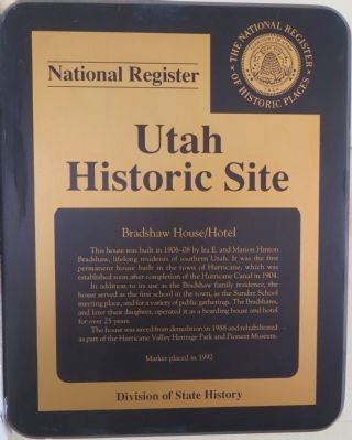
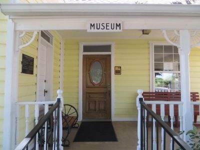
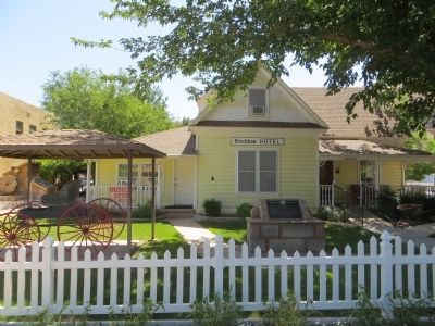
Bradshaw House/Hotel
In addition to its use as the Bradshaw family residence, the house served as the first school in the town, as the Sunday School meeting place, and for a variety of public gatherings. The Bradshaws and later their daughter, operated it as a boarding house and hotel for over 25 years.
The house was saved from demolition in 1988 and rehabilitated as part of the Hurricane Valley Heritage Park and Pioneer Museum.
Erected 1992 by Division of State Highways.
Topics. This historical marker is listed in these topic lists: Education • Notable Buildings • Settlements & Settlers. A significant historical year for this entry is 1904.
Location. 37° 10.518′ N, 113° 17.274′ W. Marker is in Hurricane, Utah, in Washington County. Marker is on South Main Street, on the right when traveling south. Touch for map. Marker is at or near this postal address: 95 South Main Street, Hurricane UT 84737, United States of America. Touch for directions.
Other nearby markers. At least 8 other markers are within walking distance of this marker. Heritage Home & Pioneer Corner (a few steps from this marker); Pioneer Trails (about 300 feet away, measured in a direct line); Hurricane Canal (about 300 feet away); Hurricane Pioneers (about 300 feet away); Hurricane City (about 400 feet away); Survival in Utah’s Dixie (about 400 feet away); The Roads to Utah’s Dixie (about 400 feet away); Historic Kolob Mountain (about 400 feet away). Touch for a list and map of all markers in Hurricane.
Credits. This page was last revised on June 16, 2016. It was originally submitted on June 20, 2014, by Bill Kirchner of Tucson, Arizona. This page has been viewed 484 times since then and 17 times this year. Photos: 1, 2, 3. submitted on June 20, 2014, by Bill Kirchner of Tucson, Arizona. • Syd Whittle was the editor who published this page.


