Croom in Prince George's County, Maryland — The American Northeast (Mid-Atlantic)
Enemy Bluff
Star-Spangled Banner Historic Trail
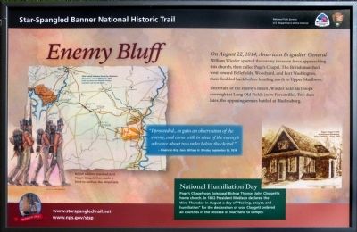
Uncertain of the enemy's intent, Winder held his troops overnight at Long Old Fields (now Forestville), two days later, the opposing armies battled at Bladensburg.
"I proceeded...to gain an observation of the enemy, and came with in view of the enemy's advance about two miles below the chapel."- American Brigadier General William H. Winder, September 26, 1814
Erected 2014 by National Park Service.
Topics. This historical marker is listed in these topic lists: Churches & Religion • War of 1812. A significant historical date for this entry is September 26, 1755.
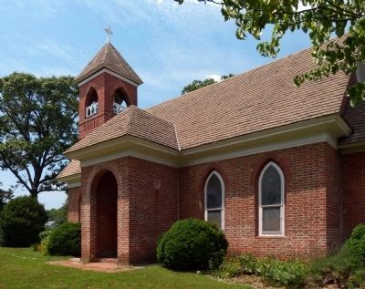
Location. 38° 44.91′ N, 76° 45.541′ W. Marker is in Croom, Maryland, in Prince George's County. Marker can be reached from Saint Thomas Church Road. Marker is in front of Saint Thomas Episcopal Church. Touch for map. Marker is at or near this postal address: 14300 Saint Thomas Church Rd, Upper Marlboro MD 20772, United States of America. Touch for directions.
Other nearby markers. At least 8 other markers are within 3 miles of this marker, measured as the crow flies. St. Thomas' Parish Church (within shouting distance of this marker); St. Simon's Episcopal Mission (about 300 feet away, measured in a direct line); Bishop Thomas John Claggett (about 300 feet away); St. Simon's Mission, 1896 (about 700 feet away); Croom (approx. ¾ mile away); Bellefields (approx. one mile away); Shaded Reprieve (approx. 2½ miles away); Eastern Bluebird (approx. 2.6 miles away). Touch for a list and map of all markers in Croom.
Also see . . .
1. St. Thomas Church Site, Maryland Inventory of Historic Properties. (Submitted on August 10, 2019.)
2. Star-Spangled Banner National Historic Trail, National Park Service. (Submitted on August 10, 2019, by David Lassman of Waldorf, Maryland.)
3. Star-Spangled Banner Byway, Maryland Office of Tourism. (Submitted on August 10, 2019.)
Photographed By Allen C. Browne, July 13, 2014
5. National Humiliation Day
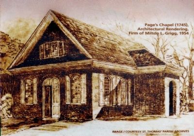
Page's Chapel was Episcopal Bishop Thomas John Claggett's home church. In 1812 President Madison declared the third Thursday in August a day of "fasting, prayer, and humiliation" for the declaration of war. Claggett ordered all churches in the Diocese of Maryland to comply.
Page's Chapel (1745) Architectural Rendering Firm of Milton L. Grigg, 1954.Close-up of drawing on marker
Page's Chapel (1745) Architectural Rendering Firm of Milton L. Grigg, 1954.
Credits. This page was last revised on August 20, 2019. It was originally submitted on July 15, 2014, by Allen C. Browne of Silver Spring, Maryland. This page has been viewed 496 times since then and 18 times this year. Photos: 1, 2. submitted on July 15, 2014, by Allen C. Browne of Silver Spring, Maryland. 3. submitted on August 10, 2019. 4, 5, 6, 7, 8, 9. submitted on July 15, 2014, by Allen C. Browne of Silver Spring, Maryland. • Bill Pfingsten was the editor who published this page.
