Bethlehem in Grafton County, New Hampshire — The American Northeast (New England)
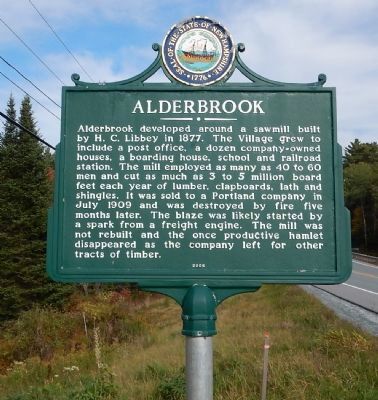
Alderbrook
Alderbrook developed around a sawmill built by H.C. Libbey in 1877. The Village grew to include a post office, a dozen company-owned houses, a boarding house, school and railroad station. The mill employed as many as 40 to 60 men and cut as much as 3 to 5 million board feet each year of lumber, clapboards, lath and shingles. It was sold to a Portland company in July 1909 and was destroyed by fire five months later. The blaze was likely started by a spark from a freight engine. The mill was not rebuilt and the once productive hamlet disappeared as the company left for other tracts of timber.
Erected 2006 by New Hampshire Division of Historical Resources. (Marker Number 198.)
Topics and series. This historical marker is listed in this topic list: Industry & Commerce. In addition, it is included in the New Hampshire Historical Highway Markers series list. A significant historical month for this entry is July 1909.
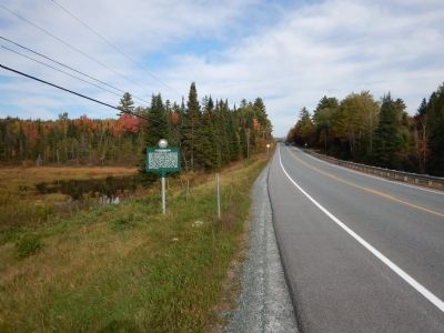
Location. 44° 19.635′ N, 71° 42.116′ W. Marker is in Bethlehem, New Hampshire, in Grafton County. Marker is at the intersection of Whitefield Road (New Hampshire Route 116) and Deer Run Road, on the right when traveling west on Whitefield Road. Touch for map. Marker is in this post office area: Bethlehem NH 03574, United States of America. Touch for directions.
Other nearby markers. At least 8 other markers are within 4 miles of this marker, measured as the crow flies. Jodo Karate (approx. 3.3 miles away); Angel of the Mountains (approx. 3.3 miles away); Sinclair Lodge (approx. 3.3 miles away); Town Building (approx. 3.3 miles away); Site of Sinclair Hotel (approx. 3.3 miles away); Frances Glessner Lee (approx. 3.4 miles away); Fanny’s Little Playhouse (approx. 3.6 miles away); Salomon Block (approx. 3.7 miles away). Touch for a list and map of all markers in Bethlehem.
Credits. This page was last revised on June 16, 2016. It was originally submitted on October 2, 2014, by Kevin Craft of Bedford, Quebec. This page has been viewed 750 times since then and 52 times this year. Photos: 1, 2. submitted on October 2, 2014, by Kevin Craft of Bedford, Quebec. • Bill Pfingsten was the editor who published this page.

