Gerolzhofen in Schweinfurt, Bavaria, Germany — Central Europe
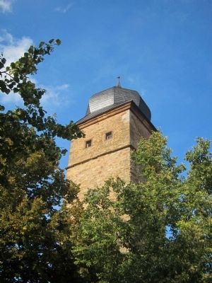
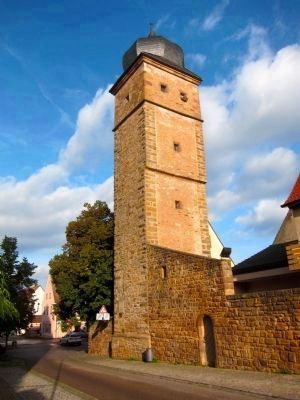
Owl's Tower
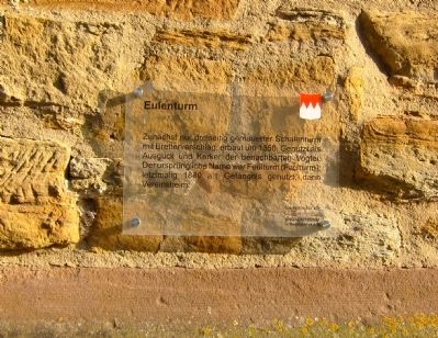
Eulenturm
Zunächst nur dreiseitig gemauerter Scbalenturm mit Bretterverschlag erbaut um 1350. Genutzt als Auslug und Kerker der benachbarten Vogtei. Der ursprüngliche Name war Feulturm (Faulturm), letztmalig 1830 als Gefängnis genutzt, dann Vereinsheim.
Geschichte für alle - historischer Verein in Gerolzhofen, e.V.
Dr. Ottmar Wolf – Kulturstiftung
English translation:
Initially, this was only three sided brick shell tower with wooden shed, built around 1350. Used as a lookout and as a dungeon of the adjacent bailiwick. The original name was Feulturm (Digester), and used as a prison for the last time in 1830, then as a society house.
History for All - the Gerolzhofen Historical Society
Dr. Ottmar Wolf Cultural Foundation
Topics. This historical marker is listed in this topic list: Forts and Castles. A significant historical year for this entry is 1350.
Location. 49° 54.049′ N, 10° 20.838′ E. Marker is in Gerolzhofen, Bayern (Bavaria), in Schweinfurt. Marker is at the intersection of Bürgermeister-Weigand Straße and Grabenstrasse, on the right when traveling west on Bürgermeister-Weigand Straße. Touch for map. Marker is at or near this postal address: Bürgermeister-Weigand Straße 4, Gerolzhofen BY 97447, Germany. Touch for directions.
Other nearby markers. At least 8 other markers are within walking distance of this marker. Ehemalige Vogtei / Former Bailiff's Building (a few steps from this marker); Patrizierhaus von 1574 / Patrician House from 1574 (within shouting distance of this marker); DenkOrt Deportationen 1941-1944 Gerolzhofen / Gerolzhofen Deportation 1941-44 Memorial (about 90 meters away, measured in a direct line); Parish Church (about 90 meters away); Baroque Crucifixion Sculpture (about 90 meters away); The Watchmen's Tower (about 90 meters away); Chapel of St. John (about 120 meters away); Centtor / "Cent" Gate (about 120 meters away). Touch for a list and map of all markers in Gerolzhofen.
Also see . . . Owl's- or Witches Tower. In translation: The strikingly tall, square Owls- or Witches-tower has 5 floors and a distinctive onion dome. It dates from the 14th - 16th century. Across the market place, about 350 meters in a direct line of sight from the "Punishment Tower". Initially, the tower was used as "Bailiwick-dungeon" for witches, and from then on until 1830 as a prison. (Submitted on October 17, 2014.)

Photographed By Andrew Ruppenstein, August 30, 2014
3. Hexen Gedenkstätte / Witches Memorial
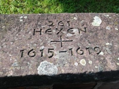
Across the street from the tower, set in a retaining wall, is a stone memorial commemorating the 261 persons in Gerolzhofen, mostly women, that were accused of witchcraft and executed. This toll does not include any number of persons who were accused and incarcerated but died prior to their trial or execution.
Credits. This page was last revised on January 28, 2022. It was originally submitted on October 3, 2014, by Andrew Ruppenstein of Lamorinda, California. This page has been viewed 429 times since then and 6 times this year. Photos: 1. submitted on October 16, 2014, by Andrew Ruppenstein of Lamorinda, California. 2, 3. submitted on October 17, 2014, by Andrew Ruppenstein of Lamorinda, California. 4. submitted on October 16, 2014, by Andrew Ruppenstein of Lamorinda, California.


