Gerolzhofen in Schweinfurt, Bavaria, Germany — Central Europe
Prison Tower
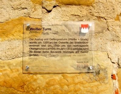
Weißer Turm
Geschichte für alle
historischer Verein in Gerolzhofen, e.V.
Dr. Ottmar Wolf - Kulturstiftung
Marker text translated into English:
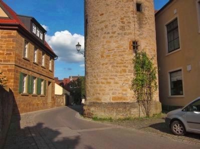
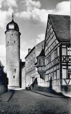
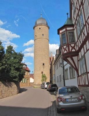
This lookout tower and prison (Weiße = punishment) was built around 1350 on the east side of the city walls, and in 1550 was made taller with the addition of the cantilevered upper floor. The 20 meter high building was used for the last time as a prison in 1803.
History for All - the Gerolzhofen Historical Society
Dr. Ottmar Wolf Cultural Foundation
Erected by The Gerolzhofen Historical Society and the Dr. Ottmar Wolf Cultural Foundation.
Topics. This historical marker is listed in this topic list: Forts and Castles. A significant historical year for this entry is 1350.
Location. 49° 54.062′ N, 10° 21.091′ E. Marker is in Gerolzhofen, Bayern (Bavaria), in Schweinfurt. Marker is on Weisse-Turm-Strasse just east of Brunnengasse, on the left when traveling east. Touch for map. Marker is at or near this postal address: Weisse-Turm-Strasse 22, Gerolzhofen BY 97447, Germany. Touch for directions.
Other nearby markers. At least 8 other markers are within walking distance of this marker. Fachwerkhaus Teutsch / Teutsch Building (within shouting distance of this marker); The Former Adminstrative Building (about 90 meters away, measured in a direct line); Spital Gate (about 120 meters away); The Beadle’s Tower (about 120 meters away); Altes Rathaus / The Old City Hall (about 150 meters away); The Decline of the Jewish Community of Gerolzhofen from January 30, 1933 (about 150 meters away); Bürgerspital / Municipal Hospital (about 180 meters away); Catholic Rectory (about 180 meters away). Touch for a list and map of all markers in Gerolzhofen.
Credits. This page was last revised on January 28, 2022. It was originally submitted on October 8, 2014, by Andrew Ruppenstein of Lamorinda, California. This page has been viewed 446 times since then and 11 times this year. Photos: 1, 2. submitted on October 9, 2014, by Andrew Ruppenstein of Lamorinda, California. 3. submitted on October 8, 2014, by Andrew Ruppenstein of Lamorinda, California. 4. submitted on October 9, 2014, by Andrew Ruppenstein of Lamorinda, California.


