Near Kenton in Hardin County, Ohio — The American Midwest (Great Lakes)
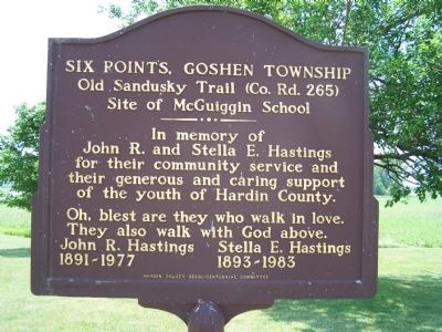
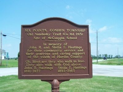
Six Points, Goshen Township
Old Sandusky Trail (Co. Rd. 265)
— Site of McGuiggin School —
Inscription.
In memory of
John R. and Stella E. Hastings
for their community service and
their generous and caring support
of the youth of Hardin County.
Oh, blest are they who walk in love. They also walk with God above.
John R. Hastings / / / Stella E. Hastings
1891 -- 1977 / / / 1893 -- 1983
Erected by Hardin County Bicentennial Committee.
Topics. This historical marker is listed in these topic lists: Charity & Public Work • Education. A significant historical year for this entry is 1891.
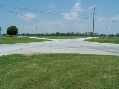
Location. 40° 39.478′ N, 83° 27.55′ W. Marker is near Kenton, Ohio, in Hardin County. Marker is at the intersection of Old Sandusky Trail (County Route 265) and County Route 120, on the right when traveling north on Old Sandusky Trail. marker is at the intersection of Co. Rds. 120, and 235 It is 1 mile N of St Rt 309 (old US 30 S), on the “Old Sandusky Trail”, ½ way between Pfeifer Station (Wheeler) and Marseilles this is the old portage between the Scioto River and Tymochtee Creek, a branch of the Sandusky River. Touch for map. Marker is at or near this postal address: 11000 County Road 265, Kenton OH 43326, United States of America. Touch for directions.
Other nearby markers. At least 8 other markers are within 7 miles of this marker, measured as the crow flies. Wheeler Tavern (approx. 3.2 miles away); Old Sandusky Trail and Shawnee Ford (approx. 3.4 miles away); LaRue Veterans Memorial (approx. 5.9 miles away); LaRue Veterans Memorial Column (approx. 5.9 miles away); Hardin County Veterans Memorial Park (approx. 6.1 miles away); Hardin County New Veterans Memorial (approx. 6.7 miles away); Jacob Parrott (approx. 6.8 miles away); Hardin County Ohio Civil War Soldier Monument (approx. 6.8 miles away). Touch for a list and map of all markers in Kenton.
Credits. This page was last revised on January 8, 2020. It was originally submitted on October 24, 2014, by Rev. Ronald Irick of West Liberty, Ohio. This page has been viewed 832 times since then and 29 times this year. Photos: 1, 2, 3, 4. submitted on October 26, 2014, by Rev. Ronald Irick of West Liberty, Ohio. • Al Wolf was the editor who published this page.


