St. Joseph in Buchanan County, Missouri — The American Midwest (Upper Plains)
The Pony Express
St. Joseph, Missouri
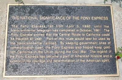
The National Significance of the Pony Express
The Pony Express ran from April 3, 1860, until the transcontinental telegraph was completed in October, 1861. The Pony Express proved that the Central Route to California could be traveled all year. Part of this route would later be used by the transcontinental railroad. By keeping government lines of communication open, the Pony Express also helped keep gold-rich California in the Union during the Civil War. The legend of the Pony Express has become a part of American folklore and a symbol of the courage and determination of the American spirit.
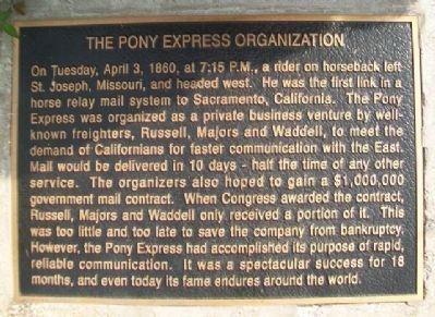
The Pony Express Organization
On Tuesday, April 3, 1860, at 7:15 P.M., a rider on horseback left St. Joseph, Missouri, and headed west. He was the first link in a horse relay mail system to Sacramento, California. The Pony Express was organized as a private business venture by well-known freighters, Russell, Majors and Waddell, to meet the demand of Californians for faster communication with the East. Mail would be delivered in 10 days - half the time of any other service. The organizers also hoped to gain a $1,000,000 government mail contract. When Congress awarded the contract, Russell, Majors and Waddell only received a portion of it. This was too little and too late to save the company from bankruptcy. However, the Pony Express had accomplished its purpose of rapid, reliable communication. It was a spectacular success for 18 months, and even today its fame endures around the world.
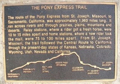
The Pony Express Trail
The route of the Pony Express from St. Joseph, Missouri, to Sacramento, California, was approximately 1,960 miles long. It ran across rivers and through prairies, plains, mountains and deserts. Relay stations, where a rider got a fresh horse, were 10 to 15 miles apart and home stations, where a new rider took the mail, were 75 to 100 miles apart. From St. Joseph, Missouri, the trail followed the Central Route to California through the present-day states of Kansas, Nebraska, Colorado, Wyoming, Utah, Nevada and California.
The Pony Express Riders
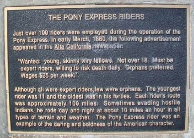
Just over 100 riders were employed during the operation of the Pony Express. In early March, 1860, the following advertisement appeared in the Alta California newspaper:
"Wanted: young, skinny wiry fellows. Not over 18. Must be expert riders, willing to risk death daily. Orphans preferred. Wages $25 per week."
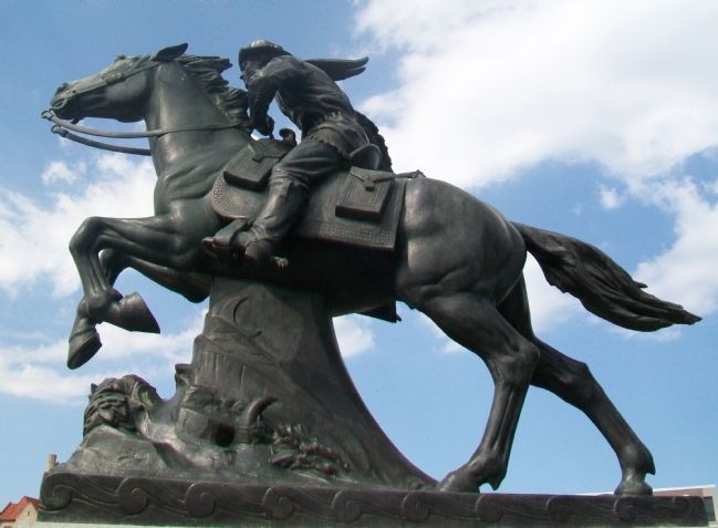
Although all were expert riders, few were orphans. The youngest rider was 11 and the oldest was in his forties. Each rider's route was approximately 100 miles. Sometimes evading hostile Indians, he rode day and night at about 10 miles an hour in all types of
terrain and weather. The Pony Express rider was an example of the daring and boldness of the American character.
Topics and series. This historical marker is listed in these topic lists: Animals • Communications. In addition, it is included in the Pony Express National Historic Trail series list. A significant historical year for this entry is 1860.
Location. 39° 46.059′ N, 94° 50.906′ W. Marker is in St. Joseph, Missouri, in Buchanan County. Monument is in the island surrounded by Frederick Avenue (I-29 Business), 10th Street (I-29 Business), and Francis Street. Touch for map. Marker is in this post office area: Saint Joseph MO 64501, United States of America. Touch for directions.
Other nearby markers. At least 8 other markers are within walking distance of this marker. War Memorial (about 300 feet away, measured in a direct line); SPC Edward "Eddie" Lee Myers (about 500 feet away); SPC Joshua James "Josh" Munger (about 500 feet away); Brian Jay Bradbury (about 500 feet away); Peace Officers Memorial (about 500 feet away); Replica of the Statue of Liberty (about 500 feet away); Krug Building (about 700 feet away); No Turning Back (about 700 feet away). Touch for a list and map of all markers in St. Joseph.
Also see . . .
1. Pony Express National Historic Trail. National Park Service website entry (Submitted on November 30, 2014, by William Fischer, Jr. of Scranton, Pennsylvania.)
2. National Pony Express Association. Association website homepage (Submitted on November 30, 2014, by William Fischer, Jr. of Scranton, Pennsylvania.)
3. Pony Express National Museum. Museum website homepage (Submitted on November 30, 2014, by William Fischer, Jr. of Scranton, Pennsylvania.)
4. St. Joseph, Jumping Off to the West. Legends of America website entry (Submitted on November 30, 2014, by William Fischer, Jr. of Scranton, Pennsylvania.)
Credits. This page was last revised on April 26, 2022. It was originally submitted on November 30, 2014, by William Fischer, Jr. of Scranton, Pennsylvania. This page has been viewed 615 times since then and 55 times this year. Photos: 1, 2, 3, 4, 5, 6, 7. submitted on November 30, 2014, by William Fischer, Jr. of Scranton, Pennsylvania.
