Eureka Springs in Carroll County, Arkansas — The American South (West South Central)
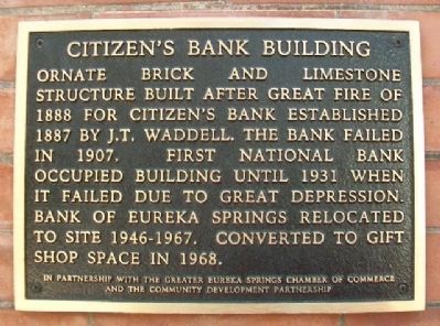
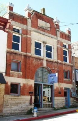
Citizen's Bank Building
Erected by Greater Eureka Springs Chamber of Commerce and the Community Development Partnership.
Topics. This historical marker is listed in these topic lists: Architecture • Industry & Commerce. A significant historical year for this entry is 1888.
Location. 36° 24.179′ N, 93° 44.218′ W. Marker is in Eureka Springs, Arkansas, in Carroll County. Marker is on Spring Street, 0.2 miles north of Main Street (Arkansas Highway 23), on the left when traveling north. Touch for map. Marker is at or near this postal address: 40 Spring Street, Eureka Springs AR 72632, United States of America. Touch for directions.
Other nearby markers. At least 8 other markers are within walking distance of this marker. Law Offices of F.O. Butt (within shouting distance of this marker); The Three Flat-Irons (within shouting distance of this marker); The Perry House - Basin Park Hotel (within shouting distance of this marker); The Stone Walls (about 300 feet away, measured in a direct line); The Springs (about 300 feet away); Mud Street to Main Street (about 300 feet away); Spanish-American and World War Veterans Memorial (about 400 feet away); The Basin Park Sycamore (about 400 feet away). Touch for a list and map of all markers in Eureka Springs.
Credits. This page was last revised on August 16, 2020. It was originally submitted on December 18, 2014, by William Fischer, Jr. of Scranton, Pennsylvania. This page has been viewed 481 times since then and 27 times this year. Photos: 1, 2. submitted on December 18, 2014, by William Fischer, Jr. of Scranton, Pennsylvania.

