Near Pensacola Beach in Escambia County, Florida — The American South (South Atlantic)
Battery 234
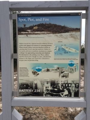
Spot, Plot, and Fire
— Fort Pickens —
Hidden beneath this vegetated mound of Battery 234 were soldiers who figured out solutions to a pressing problem: Where should artillery crews aim the guns to strike an attacking ship? It took some teamwork. Soldiers in the nearby end towers would take simultaneous compass readings of an approaching enemy ship and telephone the information to the plotting room. There, soldiers used the data to plot a triangle on the table, calculated the distance to the target, and relayed their calculation to the gun crews for precision firing.
Erected by the National Park Service, Department of the Interior.
Topics. This historical marker is listed in these topic lists: Forts and Castles • War, World II.
Location. 30° 19.302′ N, 87° 17.096′ W. Marker is near Pensacola Beach, Florida, in Escambia County. Marker can be reached from Fort Pickens Road, 9.3 miles west of Pensacola Beach Boulevard (State Road 399). Touch for map. Marker is at or near this postal address: Fort Pickens Road, Gulf Breeze FL 32561, United States of America. Touch for directions.
Other nearby markers. At least 8 other markers are within walking distance of this marker. Battery Cooper (approx. 0.2 miles away); Chasefield Plantation Cemetery (approx. ¼ mile away); Battery Worth (approx. 0.4 miles away); William Bartram Trail (approx. 0.4 miles away); Apache Prisoners (approx. half a mile away); Fort within a Fort (approx. half a mile away); Converting a Cannon (approx. half a mile away); Deadly Explosion (approx. half a mile away). Touch for a list and map of all markers in Pensacola Beach.
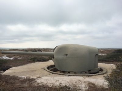
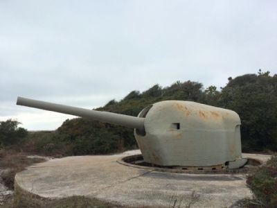
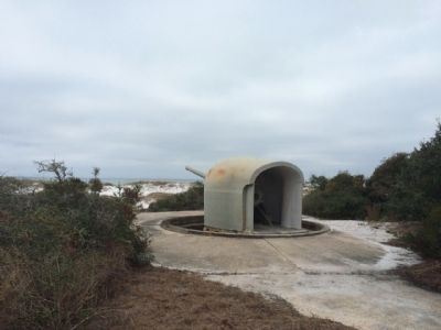
Regarding Battery 234. The sweeping German victories in the spring of 1940 sent shockwaves through the American military, prompting the building of more coast defense batteries. Japanese victories in 1941 and 1942 only increased this concern. Yet by 1943 when this battery was completed, the tide of war had swung against the Axis forces and the battery was never activated. In 1976 the Smithsonian Institute provided the National Park Service with several rare artillery pieces, three of which are now mounted at Battery 234 and Battery Cooper.
Also see . . . Fort Wiki article. (Submitted on January 2, 2015, by Mark Hilton of Montgomery, Alabama.)
Credits. This page was last revised on June 16, 2016. It was originally submitted on January 2, 2015, by Mark Hilton of Montgomery, Alabama. This page has been viewed 493 times since then and 24 times this year. Photos: 1, 2, 3, 4, 5. submitted on January 2, 2015, by Mark Hilton of Montgomery, Alabama.
