Near Clear Brook in Frederick County, Virginia — The American South (Mid-Atlantic)
West Virginia / Frederick County
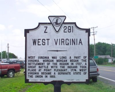
West Virginia. West Virginia was long a part of Virginia. Morgan Morgan began the settlement of the region in 1727. A great battle with the Indians took place at Point Pleasant, 1774. West Virginia became a separate state of the Union in 1863.
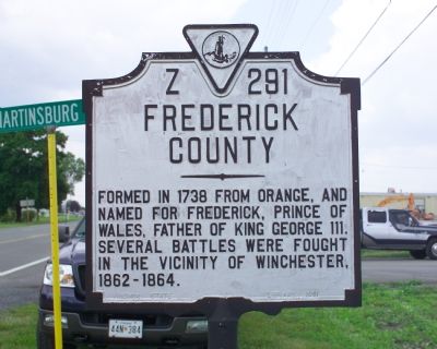
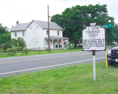
Frederick County. Formed in 1738 from Orange, and named for Frederick, Prince of Wales, father of King George III. Several battles were fought in the vicinity of Winchester, 1862–1864.
Erected 1951 by the Virginia State Library. (Marker Number Z-291.)
Topics and series. This historical marker is listed in these topic lists: Political Subdivisions • Settlements & Settlers. In addition, it is included in the Virginia Department of Historic Resources (DHR) series list. A significant historical year for this entry is 1727.
Location. 39° 17.633′ N, 78° 4.836′ W. Marker is near Clear Brook, Virginia, in Frederick County. Marker is on Martinsburg Pike (U.S. 11) near the Virginia / West Virginia line, on the left when traveling north. Touch for map. Marker is in this post office area: Clear Brook VA 22624, United States of America. Touch for directions.
Other nearby markers. At least 8 other markers are within 3 miles of this marker, measured as the crow flies. West Virginia (Berkeley County) / Virginia (about 700 feet away, measured in a direct line in West Virginia); Gettysburg Campaign (approx. 1.9 miles away in West Virginia); James Johnston Pettigrew Monument (approx. 2.6 miles away in West Virginia); Hopewell Friends Meeting House (approx. 2.7 miles away); Cool Spring Presbyterian Church (approx. 2.9 miles away in West Virginia); Morgan Cabin (approx. 2.9 miles away in West Virginia); Zacquill Morgan House (approx. 2.9 miles away in West Virginia); Morgan Chapel (approx. 3 miles away in West Virginia).
More about this marker. The Z-series Virginia markers are erected at county lines with each face visible to those about to enter the county named. This marker, being on the state line, describes the adjecent state on one of its faces.
This marker replaced an earlier marker numbered Z-216 with the same text, except that the earlier marker showed the area of Frederick county “Area 435 Square Miles.”
Credits. This page was last revised on March 14, 2022. It was originally submitted on August 4, 2007, by Tom Fuchs of Greenbelt, Maryland. This page has been viewed 1,792 times since then and 23 times this year. Last updated on March 10, 2022, by James Dean of Chesterfield, Virginia. Photos: 1, 2, 3, 4. submitted on August 4, 2007, by Tom Fuchs of Greenbelt, Maryland. • Bernard Fisher was the editor who published this page.


