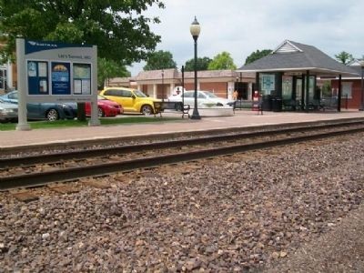
Lee's Summit in Jackson County, Missouri — The American Midwest (Upper Plains)
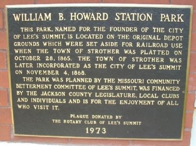
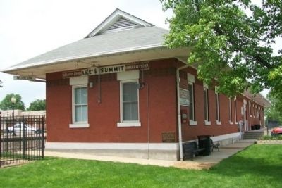
William B. Howard Station Park
The park was planned by the Missouri Community Betterment Committee of Lee's Summit, was financed by the Jackson County legislature, local clubs and individuals and is for the enjoyment of all who visit it.
Erected 1973 by the Rotary Club of Lee's Summit.
Topics and series. This historical marker is listed in these topic lists: Railroads & Streetcars • Settlements & Settlers. In addition, it is included in the Rotary International series list. A significant historical month for this entry is October 1912.
Location. 38° 54.752′ N, 94° 22.677′ W. Marker is in Lee's Summit, Missouri, in Jackson County. Marker is on SE Main Street north of SE 3rd Street, on the left when traveling north. Touch for map. Marker is at or near this postal address: 228 SE Main Street, Lees Summit MO 64063, United States of America. Touch for directions.
Other nearby markers. At least 8 other markers are within 8 miles of this marker, measured as the crow flies. All Veterans Memorial (within shouting distance of this marker); R.H. Marquette Building (within shouting distance of this marker); Harry S Truman (approx. 0.2 miles away); Flanery-Frost Cemetery (approx. 4.4 miles away); The Battle of White Oak Creek (approx. 4.8 miles away); Where Wagons Rolled / Wieduwilt Swales (approx. 7.6 miles away); Richards Flying Field (approx. 7.8 miles away); The Barnes Enclosure (approx. 8 miles away). Touch for a list and map of all markers in Lee's Summit.
Also see . . .
1. The History of Lee's Summit MO. (Submitted on February 8, 2015, by William Fischer, Jr. of Scranton, Pennsylvania.)
2. William B. Howard at Find A Grave. (Submitted on February 8, 2015, by William Fischer, Jr. of Scranton, Pennsylvania.)
Credits. This page was last revised on February 10, 2023. It was originally submitted on February 8, 2015, by William Fischer, Jr. of Scranton, Pennsylvania. This page has been viewed 433 times since then and 11 times this year. Photos: 1, 2, 3, 4, 5. submitted on February 8, 2015, by William Fischer, Jr. of Scranton, Pennsylvania.
