Cameron in Coconino County, Arizona — The American Mountains (Southwest)
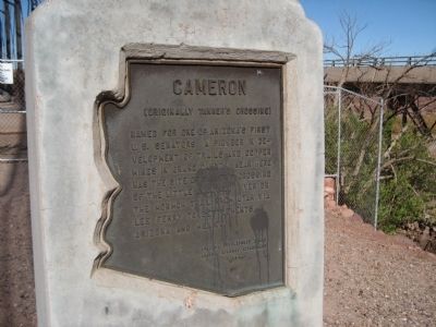
Cameron
Originally Tanner's Crossing
Erected 1960 by Arizona Development Board/Arizona Highway Department.
Topics. This historical marker is listed in these topic lists: Notable Places • Settlements & Settlers.
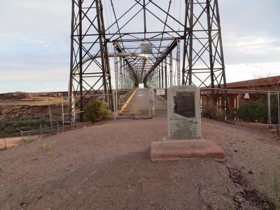
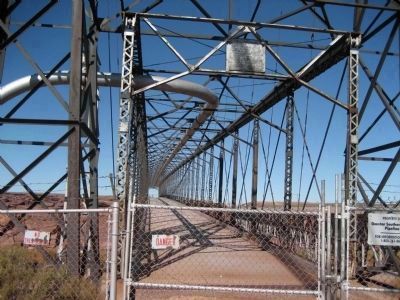
Location. 35° 52.578′ N, 111° 24.721′ W. Marker is in Cameron, Arizona, in Coconino County. Marker can be reached from U.S. 89, on the left when traveling north. Marker is located near the Cameron Trading Post, to the north end of the parking lot. One marker is on a stone on the ground. One marker is affixed to the top of the bridge. Touch for map. Marker is in this post office area: Cameron AZ 86020, United States of America. Touch for directions.
Regarding Cameron. Information from The Rough Guide to the Grand Canyon By Greg Ward, Rough Guides
The Mormon Trail originally crossed the Little Colorado River at a rocky ford six miles upstream. That became known as Tannerís Crossing, in honor of Seth Tanner, a Mormon prospector from Tuba City who built a house nearby in the 1870ís. He later expanded his operations into the Grand Canyon area, where he also gave his name to the Tanner Trail.
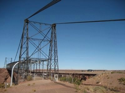
The danger from quicksand and flooding at Tannerís Crossing led to the construction of the first suspension bridge across the gorge in 1911, Cameron – named for another legendary canyon prospector, Ralph Cameron – developed on the south side of the span. That one-lane bridge is still there, but now it only carries an oil pipeline, having been superseded by a broader modern highway bridge.
The Cameron Trading Post, clustered beside the two bridges, remains what it started out as in 1916 – a trading center for the Navajo Nation. Residents still stock up on supplies, catch up with friends, fill up their gas tanks, and pick up their mail, and much of the trading postís business is still conducted by barter.
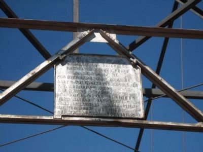
Photographed By Wyndfire, October 25, 2009
5. Sign on Suspension Bridge
The Midland Bridge Co.
Freygang and Tro Con Prop 8.
Kansas City, Mo.
For Office of Indian Affairs
Robt. G. Valentine, Commissioner
F. H. Abbott, 1st Asst
C. F. Hauke, 2nd Asst
W. H. Gode, Chief Engineer
John Charles, Supervisor
John J. Granville Construction
H. F. Robinson, Resident
Gen. W. A. Marshall, Consulting
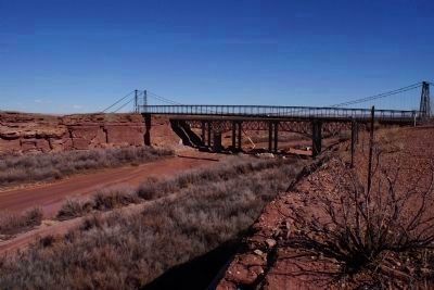
Photographed By Chris English, October 2, 2015
6. Arizona Constructs the Third Bridge at this Point on the Little Colorado
As Cameron become more sophisticated and traffic on US 89 explodes, 104 years after the Bureau of Indian Affairs bridge, and 52 years after the US 89 span, the Arizona Department of Transportation is completing a major overhaul of the local transportation system. A third bridge over the Little Colorado River is a major component of this project.
Credits. This page was last revised on June 16, 2016. It was originally submitted on November 28, 2010, by Jennifer W. of Las Cruces, New Mexico. This page has been viewed 1,447 times since then and 61 times this year. Last updated on February 10, 2015, by Chris English of Phoenix, Arizona. Photos: 1. submitted on November 28, 2010, by Jennifer W. of Las Cruces, New Mexico. 2. submitted on May 24, 2016, by Bill Kirchner of Tucson, Arizona. 3, 4, 5. submitted on December 1, 2010, by Jennifer W. of Las Cruces, New Mexico. 6. submitted on February 10, 2015, by Chris English of Phoenix, Arizona. • Syd Whittle was the editor who published this page.
