Near Murphys in Calaveras County, California — The American West (Pacific Coastal)
Douglas Flat
Topics. This historical marker is listed in these topic lists: Landmarks • Notable Buildings. A significant historical year for this entry is 1857.
Location. Marker has been reported missing. It was located near 38° 6.84′ N, 120° 27.288′ W. Marker was near Murphys, California, in Calaveras County. Marker was at the intersection of Main Street (State Highway 4 at milepost 27.5), and Monge Ranch Road on Main Street. The remains of Douglas Flats can be seen from the frontage road which paralels State Highway 4, on the north side of the highway. Most maps name the frontage road as “Main St” while others list it as “Douglas Flats Rd.”. Touch for map. Marker was in this post office area: Murphys CA 95247, United States of America. Touch for directions.
Other nearby markers. At least 8 other markers are within 2 miles of this location, measured as the crow flies. The Italian Store (approx. 0.2 miles away); Site of Brownsville (approx. 1.2 miles away); Joseph Schachten (approx. 1.4 miles away); Murphys Grammar School (approx. 1˝ miles away); Buena Vista Cemetery (approx. 1˝ miles away); Murphys' Oldest Wooden Home (approx. 1.6 miles away); Dunbar House (approx. 1.6 miles away); Ebbetts Pass Veterans Memorial (approx. 1.6 miles away). Touch for a list and map of all markers in Murphys.
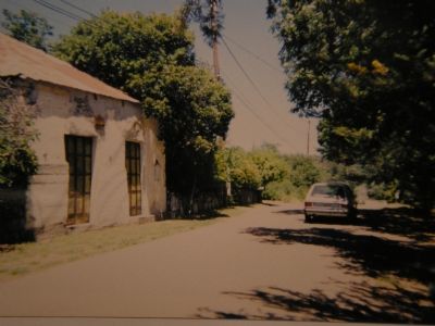
More about this marker. No State Historic Landmark plaque exists for the town site, However the remains of some of the old building of the town are still present.
Editors Note: There was a state plaque mounted on a rock on the road near Hwy 4. I visited it in the late 70's and did get photos. I am trying to locate them.

Photographed By Syd Whittle, August 3, 2008
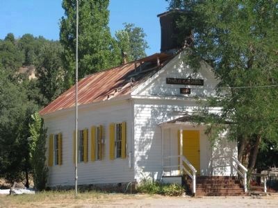
3. Douglas Flat Schoolhouse
The schoolhouse is the oldest surviving schoolhouse in Calaveras County. It was built in either 1854 or 1856, depending on which history you read. Today the building serves as the Douglas Flat Community Center.
This building was placed on the National Register of Historical Places on May 24, 1973.
Credits. This page was last revised on June 16, 2016. It was originally submitted on September 18, 2007, by Mathew H. Kohnen of San Jose, California. This page has been viewed 2,208 times since then and 19 times this year. Last updated on March 19, 2015, by J. Makali Bruton of Accra, Ghana. Photos: 1. submitted on September 20, 2007. 2. submitted on September 18, 2007, by Mathew H. Kohnen of San Jose, California. 3. submitted on August 19, 2008, by Syd Whittle of Mesa, Arizona. • Bill Pfingsten was the editor who published this page.

