Madisonville in Monroe County, Tennessee — The American South (East South Central)
Monroe County Courthouse
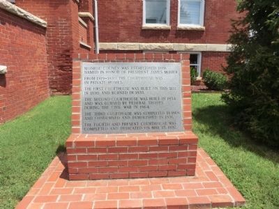
Monroe County was established 1819; Named in honor of President James Monroe.
From 1819-1830 the Courthouse was in private homes.
The first courthouse was built on this site in 1830 and burned in 1833.
The second courthouse was built in 1834 and was burned by Federal troops during the Civil War in 1864.
The third courthouse was completed in 1868 and condemned and demolished in 1896.
The fourth and present courthouse was completed and dedicated on May 15, 1897.
Topics. This historical marker is listed in this topic list: Settlements & Settlers. A significant historical date for this entry is May 15, 1897.
Location. 35° 31.203′ N, 84° 21.802′ W. Marker is in Madisonville, Tennessee, in Monroe County. Marker is on College Street south of Main Street, on the left when traveling south. Touch for map. Marker is at or near this postal address: 103 College Street, Madisonville TN 37354, United States of America. Touch for directions.
Other nearby markers. At least 8 other markers are within 4 miles of this marker, measured as the crow flies. War Comes to Madisonville (here, next to this marker); Monroe County World War II Memorial (here, next to this marker); Monroe County World War I Supreme Sacrifice Memorial (within shouting distance of this marker); Monroe County Iraq and Afghanistan KIA Memorial (within shouting distance of this marker); Monroe County Korean and Vietnam Wars Memorial (within shouting distance of this marker); In Memory of Those Who Served (within shouting distance of this marker); Estes Kefauver (approx. 0.6 miles away); Old Federal Road (approx. 3.8 miles away). Touch for a list and map of all markers in Madisonville.
Credits. This page was last revised on June 16, 2016. It was originally submitted on October 16, 2013, by Don Morfe of Baltimore, Maryland. This page has been viewed 530 times since then and 24 times this year. Last updated on April 8, 2015, by J. Makali Bruton of Accra, Ghana. Photos: 1, 2. submitted on October 15, 2013, by Don Morfe of Baltimore, Maryland. • Bill Pfingsten was the editor who published this page.

