Near Robert Lee in Coke County, Texas — The American South (West South Central)
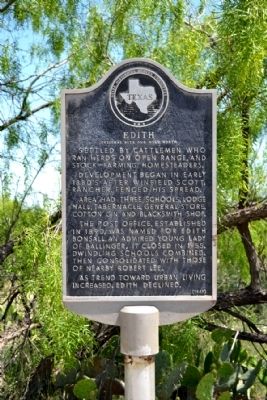
Edith
Original Site One Mile North
Settled by cattlemen who ran herds on open range, and stock-farming homesteaders.
Development began in early 1880's after Winfield Scott, rancher, fenced his spread.
Area had three schools, lodge hall, tabernacle, general store, cotton gin and blacksmith shop.
The post office, established in 1890, was named for Edith Bonsall, an admired young lady of Ballinger. It closed in 1955. Dwindling schools combined, then consolidated with those of nearby Robert Lee.
As trend toward urban living increased, Edith declined.
Erected 1969 by State Historical Survey Committee. (Marker Number 1390.)
Topics. This historical marker is listed in this topic list: Settlements & Settlers. A significant historical year for this entry is 1890.
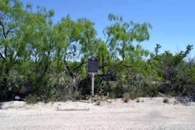
Location. 31° 54.204′ N, 100° 36.617′ W. Marker is near Robert Lee, Texas, in Coke County. Marker is at the intersection of State Highway 158 and Dripping Springs Road, on the right when traveling west on State Highway 158. Touch for map. Marker is in this post office area: Robert Lee TX 76945, United States of America. Touch for directions.
Other nearby markers. At least 8 other markers are within 8 miles of this marker, measured as the crow flies. Silver (approx. 7.2 miles away); Coke County Jail (approx. 7.2 miles away); Hayrick Lodge 696, A.F.&A.M. (approx. 7.3 miles away); County Named for Texas Confederate Richard Coke (approx. 7.3 miles away); First Methodist Church of Robert Lee (approx. 7.3 miles away); Fence-Cutting War (approx. 7.4 miles away); Natural Landmark Shelving Rock (approx. 7.8 miles away); Robert Lee Cemetery (approx. 7.9 miles away). Touch for a list and map of all markers in Robert Lee.
Also see . . . Edith, TX. From the Texas State Historical Association’s “Handbook of Texas Online”. (Submitted on May 8, 2015.)
Credits. This page was last revised on November 2, 2020. It was originally submitted on May 8, 2015, by Duane Hall of Abilene, Texas. This page has been viewed 599 times since then and 41 times this year. Photos: 1, 2, 3, 4. submitted on May 8, 2015, by Duane Hall of Abilene, Texas.


