Fort York in Toronto, Ontario — Central Canada (North America)
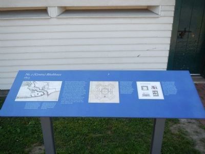
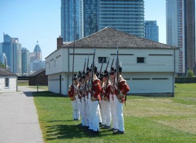
No. 2 (Centre) Blockhouse
1813

Photographed By Barry Swackhamer, August 10, 2014
1. No. 2 (Centre) Blockhouse Marker
Click on the image to enlarge the panel and view the captioned map and plans.
Captions: (left) This map shows the fort being rebuilt after the two American attacks in 1813. The three blockhouses provided ‘front-line’ protection before the rest of the fort’s walls were built. The west-end blockhouse apparently caught fire during construction and was not replaced. (Map by George Williams, Royal Military Surveyor and Draughtsman, 1813, Library and Archives Canada). (center) The British army built 13 blockhouses in Toronto between 1793 and 1838. The town blockhouse of 1798 was intended to protect the civilian community from attack during a period of tension with the local Mississaugaus. Its diagonal upper floor improved the field field of fire, and was a common feature in blockhouses built outside larger fortifications. (Plan by Captain William Graham, York Militia, 1798, Library and Archives Canada). (right) The 1813-14 Gibraltar Point Blockhouse
In 1813-14, a blockhouse was built at Gibraltar Point south of the harbour channel opposite the fort. It had an open deck on its upper floor for artillery, a traversing platform to maximize the gun’s field of fire, and could heat ‘hot shot’ to set enemy ships on fire. The walls had a double layer of logs filled with tightly-packed earth or rubble. (Modern drawing, based on a plan by Lieutenant Elias Durnford, Royal Engineers, 1823, Library and Archives of Canada).
As well as barracks, the blockhouses served as storage facilities, emergency housing for immigrants in the 1820s, hospitals during the cholera epidemic in the 1830s and drill sheds for the militia after 1867.
Topics. This historical marker is listed in this topic list: Forts and Castles. A significant historical year for this entry is 1812.
Location. 43° 38.348′ N, 79° 24.172′ W. Marker is in Toronto, Ontario. It is in Fort York. Marker can be reached from Fort York Boulevard, on the right when traveling west. Touch for map. Marker is at or near this postal address: 250 Fort York Boulevard, Toronto ON M5V 3K9, Canada. Touch for directions.
Other nearby markers. At least 8 other markers are within walking distance of this marker. Officers' Blue Barracks (within shouting distance of this marker); Brick Magazine (within shouting distance of this marker); Circular, or Government House, Battery (within shouting distance of this marker); Fort York / Le Fort York (within shouting distance of this marker); No. 1 (East) Blockhouse (within shouting distance of this marker); Government House (within shouting distance of this marker); Stone Magazine (about 90 meters away, measured in a direct line); Well and Well House (about 90 meters away). Touch for a list and map of all markers in Toronto.
More about this marker. The parking lot and entrance to Fort York is on Garrison Street.
Credits. This page was last revised on January 24, 2022. It was originally submitted on May 26, 2015, by Barry Swackhamer of Brentwood, California. This page has been viewed 418 times since then and 22 times this year. Photos: 1, 2. submitted on May 26, 2015, by Barry Swackhamer of Brentwood, California. • Andrew Ruppenstein was the editor who published this page.
