Near Boston in Rappahannock County, Virginia — The American South (Mid-Atlantic)
Rappahannock County / Culpeper County
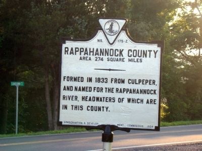
Rappahannock County. Area 274 square miles. Formed in 1833 from Culpeper, and named for the Rappahannock River, headwaters of which are in this county.
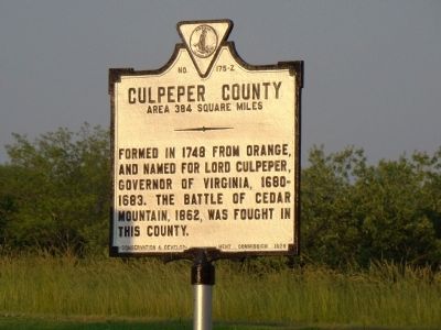
Culpeper County. Area 384 square miles. Formed in 1748 from Orange, and named for Lord Culpeper, Governor of Virginia, 1680–1683. The battle of Cedar Mountain, 1862, was fought in this county.
Erected 1929 by Conservation & Development Commission. (Marker Number Z-175.)
Topics and series. This historical marker is listed in this topic list: Political Subdivisions. In addition, it is included in the Virginia Department of Historic Resources (DHR) series list. A significant historical year for this entry is 1833.
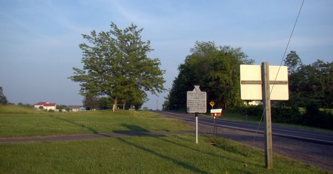
Location. 38° 33.072′ N, 78° 8.368′ W. Marker is near Boston, Virginia, in Rappahannock County. Marker is at the intersection of Sperryville Pike (U.S. 522) and Obannons Mill Road (County Route 650), on the right when traveling north on Sperryville Pike. Marker is just past the county line across Sundown Lane. Touch for map. Marker is in this post office area: Boston VA 22713, United States of America. Touch for directions.
Other nearby markers. At least 8 other markers are within 8 miles of this marker, measured as the crow flies. John Jackson—Traditional Musician (approx. 4 miles away); Milroy's Camp (approx. 4.2 miles away); Mosby and Sneden (approx. 4.2 miles away); Woodville (approx. 4.2 miles away); Slate Mills (approx. 4.7 miles away); F. T. Baptist Church (approx. 5.2 miles away); Madison County / Rappahannock County (approx. 5.7 miles away); Madison County / Culpeper County (approx. 7˝ miles away).
Also see . . . Battle of Cedar Mountain. “As Jackson headed west John Pope was concentrating his forces at Culpepper Court House between the Rappahannock and Rapidan Rivers. ... Just east of the Blue Ridge Mountains, Cedar Mountain is a twin peak rising roughly 300 feet above the fertile farmland below. Some locals call the mountain Slaughter Mountain from the name of a family that owned the land on the north end of the mountain (where the battle occurred). The North Fork of Cedar Run is big enough to be an obstacle to advancing troops, but the South Fork and other tributaries are much too small to be of any value to a commander.” (Submitted on June 19, 2008.)
Credits. This page was last revised on July 9, 2021. It was originally submitted on June 19, 2008, by J. J. Prats of Powell, Ohio. This page has been viewed 1,053 times since then and 28 times this year. Photos: 1, 2, 3. submitted on June 19, 2008, by J. J. Prats of Powell, Ohio.


