Marker Logo HMdb.org THE HISTORICAL
MARKER DATABASE
“Bite-Size Bits of Local, National, and Global History”
Near Eceabat, Çanakkale, Turkey — West Asia or Southeast Europe
 

Lone Pine Cemetery


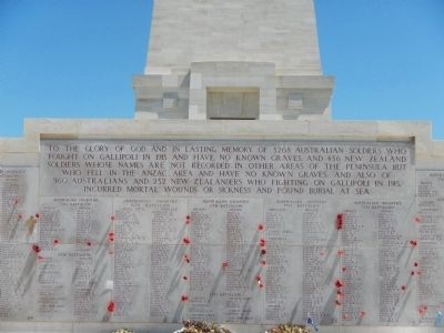
Lone Pine Cemetery Marker image. Click for full size.
Photographed By Barry Swackhamer, May 10, 2015
1. Lone Pine Cemetery Marker
Inscription.
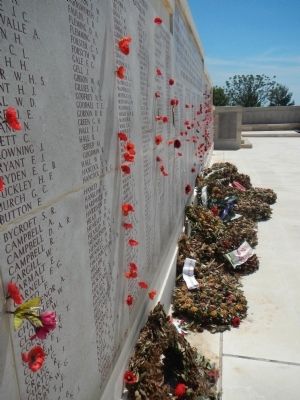
To the glory of God and the lasting memory of 3268 Australian soldiers who fought on Gallipoli in 1915 and have no known graves, and 456 New Zealand soldiers whose names are not recorded in any other areas of the peninsula but who fell in the Anzac area and have no known graves; and also of 960 Australians and 252 New Zealanders who fighting on Gallipoli in 1915, incurred mortal wounds or sickness and found burial at sea.

 
Erected by Commonwealth War Graves Commission.
 
Topics. This memorial is listed in this topic list: War, World I.
 
Location. 40° 13.821′ N, 26° 17.256′ E. Marker is near Eceabat, Çanakkale. Memorial can be reached from Edirne Çanakkale Yolu (Route E87/D55). Touch for map. Marker is in this post office area: Eceabat, Çanakkale 17900, Turkey. Touch for directions.
 
Other nearby markers. At least 8 other markers are within walking distance of this marker. The Gallipoli Campaign of 1915 (within shouting distance of this marker); Beach Cemetery (approx. one kilometer away); Anzac Cove (approx. one kilometer away); 57th Infantry Regiment (approx. 1.2 kilometers away); Monument of Respect for the Mehmetcik (approx. 1.2 kilometers away); North Beach & Sphinx (approx. 1.3 kilometers away); Ariburnu
Paid Advertisement
Click on the ad for more information.
Please report objectionable advertising to the Editor.
Click or scan to see
this page online
(approx. 1.3 kilometers away); Anzac Commemorative Site (approx. 1.3 kilometers away). Touch for a list and map of all markers in Eceabat.
 
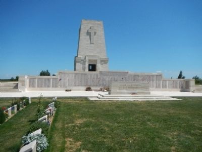
More about this marker. The Lone Pine Cemetery is located in the Çanakkale Savaşı (Battle of Çanakkale, Battle of Gallipoli) memorial park grounds. Internal park roads are not named, at least on the park map or Google maps. Most roads inside the park are one-way and signs point the way to the various cemeteries and sights.
 
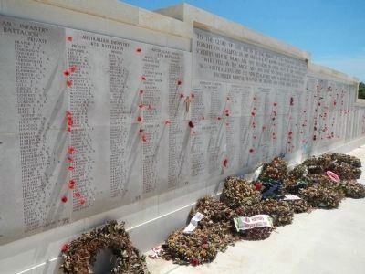
Lone Pine Cemetery Marker image. Click for full size.
Photographed By Barry Swackhamer, May 10, 2015
2. Lone Pine Cemetery Marker
Lone Pine Cemetery image. Click for full size.
Photographed By Barry Swackhamer, May 10, 2015
3. Lone Pine Cemetery
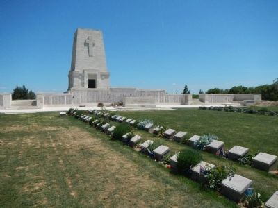
Lone Pine Cemetery image. Click for full size.
Photographed By Barry Swackhamer, May 10, 2015
4. Lone Pine Cemetery
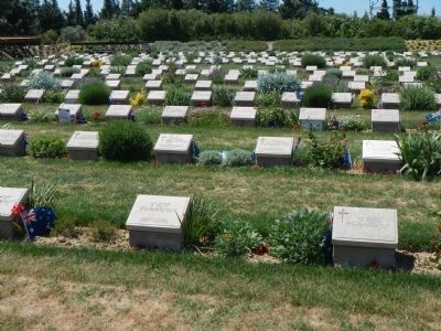
Lone Pine Cemetery image. Click for full size.
Photographed By Barry Swackhamer, May 10, 2015
5. Lone Pine Cemetery
Lone Pine Cemetery image. Click for full size.
Photographed By Barry Swackhamer, May 10, 2015
6. Lone Pine Cemetery
 
 
Credits. This page was last revised on June 16, 2016. It was originally submitted on July 6, 2015, by Barry Swackhamer of Brentwood, California. This page has been viewed 416 times since then and 24 times this year. Photos:   1, 2, 3, 4, 5, 6. submitted on July 6, 2015, by Barry Swackhamer of Brentwood, California. • Andrew Ruppenstein was the editor who published this page.
Share this page.  
Share on Tumblr
m=85110

CeraNet Cloud Computing sponsors the Historical Marker Database.
This website earns income from purchases you make after using our links to Amazon.com. We appreciate your support.
Paid Advertisement
Apr. 26, 2024