Eceabat, Çanakkale, Turkey — West Asia or Southeast Europe
Chunuk Bair
Çanak Bayırı
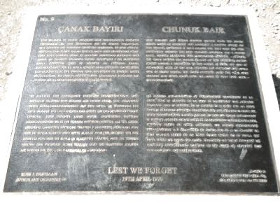
New Zealand and British Forces climbed from the beach under cover of darkness and launched a surprise attack on this hilltop, capturing it on 8 August 1915. They held the area immediately around the New Zealand Memorial for 2 nights until, against constant and courageous counter-attacks the Turks retook the summit. As part of this offensive, British Forces landed 7 kilometers to the north at Suvla Bay and by mid-August most of the area between the foothills and Suvla was in Allied hands. The Turks however, held the vital high ground and never again were the Allies to view their goal - the Dardanelles.
Turkish:
Yeni Zelanda ve İngiliz askerleri gece karanlıǧında sahilden tırmanarak bu tepe üzerinden ani bir saldırı başlattılar ve 8 Aǧustos 1915 tarihinde tepeyi ele geçirdiler. İki gece süreyle müttefiklerin elinde kalan Yeni Zelanda anıtı civarındaki bölge Türk kuvvetlerinin cesur ve aralıksız saldırları sonunda geri alında. Bu taarruz sırasında İngiliz kuvvetleri 7 kn kuzeydeki Suvla körfezine çıktı ve Aǧustos ayı ortasına kadar bulunduğunuz yer ile Suvla körfezi arası müttefik kuvvetlerin kontrolündeydi. Öte yandan Türk kuvvetleri de statejik tepeyi bırakmadılar. Bu durum müttefiklerin Çanakkale boǧazını ele geçirme amaçlarının gerçekleşemeyeceǧi demekti.
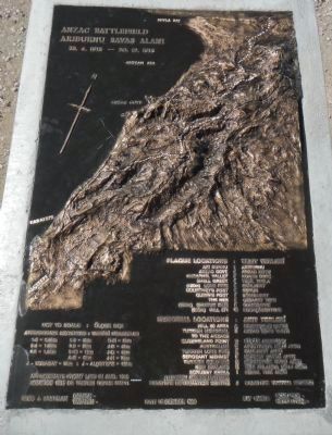
German: The German text is at the bottom left, click on the marker image to enlarge and read it.
French: The French text is at the bottom right, click on the marker image to enlarge and read it.
25th April 1990
Erected 1990. (Marker Number 9.)
Topics. This historical marker is listed in this topic list: War, World I. A significant historical date for this entry is April 25, 1990.
Location. 40° 15.141′ N, 26° 18.485′ E. Marker is in Eceabat, Çanakkale. Marker can be reached from Edirne Çanakkale Yolu, on the left when traveling north. Touch for map. Marker is in this post office area: Eceabat, Çanakkale 17900, Turkey. Touch for directions.
Other nearby markers. At least 8 other markers are within 3 kilometers of this marker, measured as the crow flies. The Moment When Mustafa Kemal Was Granted to Our Nation (with his own words) (a few steps from this marker); The Nek - Sergeant Mehmet's Memorial (approx. 1.8 kilometers away); The Nek (approx. 1.8 kilometers away); The Nek Cemetery (approx. 1.9 kilometers away); 57th Infantry Regiment (approx. 1.9 kilometers away); Anzac Commemorative Site (approx. 2.6 kilometers away); North Beach & Sphinx (approx. 3 kilometers away); Lone Pine Cemetery (approx. 3 kilometers away). Touch for a list and map of all markers in Eceabat.
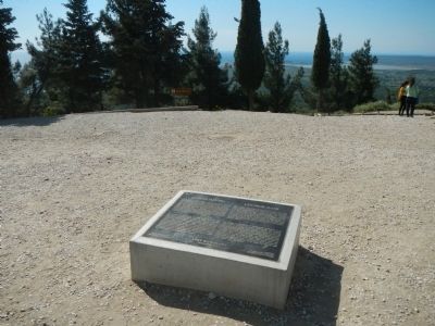
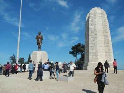
More about this marker. This marker is located close to the monuments to Mustafa Kemal and the New Zealanders in the Çanakkale Savaşı (Battle of Çanakkale, Battle of Gallipoli) memorial park grounds. Internal park roads are not named, at least on the park map or Google maps. Most road inside the park are one-way and signs point the way to the various cemeteries and sights
Credits. This page was last revised on June 16, 2016. It was originally submitted on July 7, 2015, by Barry Swackhamer of Brentwood, California. This page has been viewed 317 times since then and 10 times this year. Photos: 1, 2, 3, 4. submitted on July 7, 2015, by Barry Swackhamer of Brentwood, California. • Andrew Ruppenstein was the editor who published this page.


