Grant in Marshall County, Alabama — The American South (East South Central)
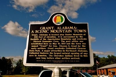
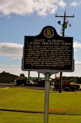
Grant, Alabama: A Scenic Mountain Town
Erected 2010 by Alabama Tourism Department and the Town of Grant.
Topics. This historical marker is listed in this topic list: Settlements & Settlers. A significant historical month for this entry is May 1847.
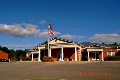
Location. 34° 31.087′ N, 86° 15.323′ W. Marker is in Grant, Alabama, in Marshall County. Marker is on Main Street / Catherdral Caverns Highway (County Route 5) near 10th Street W. Marker is in front of the Town Hall. Touch for map. Marker is at or near this postal address: 4766 Main Street, Grant AL 35747, United States of America. Touch for directions.
Other nearby markers. At least 8 other markers are within 8 miles of this marker, measured as the crow flies. Becker Hall (approx. 1.1 miles away); Pennsylvania Bell Tower (approx. 1.1 miles away); Kate Duncan Smith - Daughters of the American Revolution School (approx. 1.1 miles away); Cathedral Caverns (approx. 4.1 miles away); Whitaker Cemetery (approx. 4.8 miles away); Decatur County (approx. 6.2 miles away); Walnut Grove Cumberland Presbyterian Church (approx. 7.3 miles away); Hayden Cemetery (approx. 7.3 miles away). Touch for a list and map of all markers in Grant.
Credits. This page was last revised on June 16, 2016. It was originally submitted on August 14, 2014, by Sandra Hughes Tidwell of Killen, Alabama, USA. This page has been viewed 1,137 times since then and 143 times this year. Last updated on July 20, 2015, by J. Makali Bruton of Accra, Ghana. Photos: 1, 2, 3, 4. submitted on August 14, 2014, by Sandra Hughes Tidwell of Killen, Alabama, USA. • Bernard Fisher was the editor who published this page.


