Birmingham in Oakland County, Michigan — The American Midwest (Great Lakes)
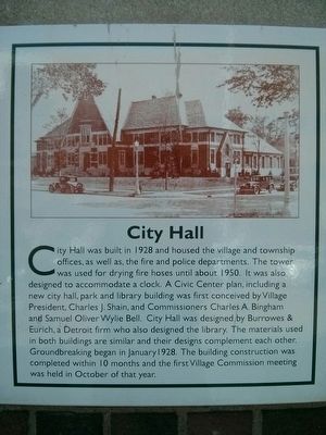
City Hall
Topics. This historical marker is listed in this topic list: Notable Buildings. A significant historical month for this entry is January 1928.
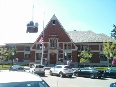
Location. 42° 32.744′ N, 83° 12.931′ W. Marker is in Birmingham, Michigan, in Oakland County. Marker is at the intersection of Martin Street and Pierce Street, on the right when traveling east on Martin Street. Touch for map. Marker is at or near this postal address: 151 Martin Street, Birmingham MI 48009, United States of America. Touch for directions.
Other nearby markers. At least 8 other markers are within walking distance of this marker. Field Building (about 300 feet away, measured in a direct line); The Quarton Building (about 400 feet away); Billy McBride Building (about 400 feet away); Johnston-Shaw Building (about 400 feet away); Ford Building (about 500 feet away); The Erity-Nixon Building (about 500 feet away); Bell Building (about 500 feet away); The National Bank Building (about 600 feet away). Touch for a list and map of all markers in Birmingham.
More about this marker. Marker is just left of the main entrance.

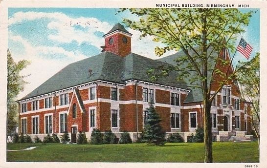
Postcard by Curteich, 1933
3. Municipal Building, Birmingham, Mich.
The postcard does confirm the marker's assertion that on the tower there was space provided for a clock. But it does raise the question - why then didn't they put a clock in the space provided there, as one would assume was intended.
Credits. This page was last revised on July 5, 2022. It was originally submitted on July 27, 2015, by Joel Seewald of Madison Heights, Michigan. This page has been viewed 355 times since then and 33 times this year. Photos: 1, 2. submitted on July 27, 2015, by Joel Seewald of Madison Heights, Michigan. 3. submitted on July 27, 2015. • Andrew Ruppenstein was the editor who published this page.

