Near Haverhill in Grafton County, New Hampshire — The American Northeast (New England)
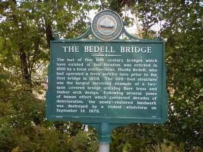
The Bedell Bridge
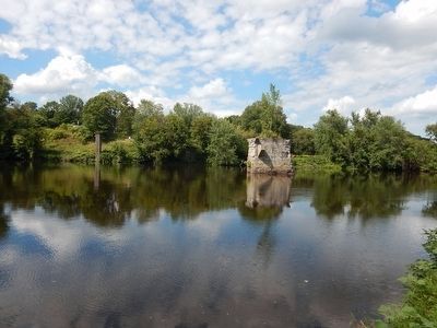
The last of five 19th century bridges which have existed at this location was erected in 1866 by a local entrepreneur, Moody Bedell, who had operated a ferry service here prior to the first bridge in 1805. The 396-foot structure was the largest surviving example of a two-span covered bridge utilizing Burr truss and timber arch design. Following several years of human effort which corrected the decades of deterioration, the newly-restored landmark was destroyed by a violent windstorm on September 14, 1979.
Erected 1980 by New Hampshire Division of Historical Resources. (Marker Number 136.)
Topics and series. This historical marker is listed in this topic list: Bridges & Viaducts. In addition, it is included in the New Hampshire Historical Highway Markers series list. A significant historical date for this entry is September 14, 1979.
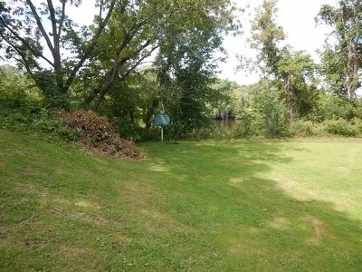
Location. 44° 2.693′ N, 72° 4.42′ W. Marker is near Haverhill, New Hampshire, in Grafton County. Marker is on Meadow Lane, 0.8 miles west of Dartmouth College Highway (New Hampshire Route 10), on the right when traveling west. Marker is near the boat launch in Bedell Bridge State Park. Touch for map. Marker is in this post office area: Haverhill NH 03765, United States of America. Touch for directions.
Other nearby markers. At least 8 other markers are within 4 miles of this marker, measured as the crow flies. Haverhill Corner Historic District (approx. 0.9 miles away); Haverhill World War Memorial (approx. 0.9 miles away); General Jacob Bayley (approx. 2˝ miles away in Vermont); Jacob Bayley (approx. 2˝ miles away in Vermont); Elmbank (approx. 2.8 miles away in Vermont); Bradford (approx. 3 miles away in Vermont); Col. Thomas Johnson (approx. 3.2 miles away in Vermont); Old Court House (approx. 3.3 miles away in Vermont). Touch for a list and map of all markers in Haverhill.
Also see . . . Wikipedia - Bedell Covered Bridge. (Submitted on September 1, 2015, by Kevin Craft of Bedford, Quebec.)

Photographed By Kevin Craft, August 26, 2015
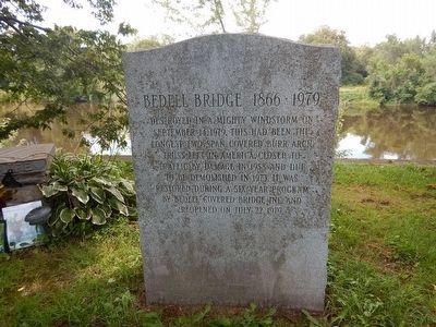
4. Another Bedell Bridge Marker
September 14, 1979. This had been the
longest two span covered burr arch
truss left in America. Closed to
traffic by damage in 1958 and due
to be demolished in 1973. It was
restored during a six year program
by Bedell Covered Bridge Inc. and
reopened on July 22, 1979.
Credits. This page was last revised on June 16, 2016. It was originally submitted on September 1, 2015, by Kevin Craft of Bedford, Quebec. This page has been viewed 364 times since then and 26 times this year. Photos: 1, 2, 3, 4. submitted on September 1, 2015, by Kevin Craft of Bedford, Quebec.


