Snyder in Scurry County, Texas — The American South (West South Central)
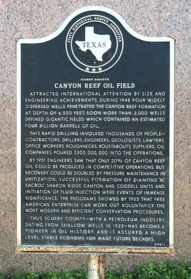
Scurry County's Canyon Reef Oil Field
Attracted international attention by size and engineering achievements. During 1948 four widely dispersed wells penetrated the Canyon Reef Formation at depth of 6,500 feet. Soon more than 2,000 wells defined gigantic fields which contained an estimated four billion barrels of oil.
This rapid drilling involved thousands of people—contractors, drillers, engineers, geologists, lawyers, office workers, roughnecks, roustabouts, suppliers. Oil companies poured $300,000,000 into the operations.
By 1951 engineers saw that only 20% of Canyon Reef oil could be produced in competitive operations, but recovery could be doubled by pressure maintenance in unitization. Successful formation of Diamond "M", Sacroc, Sharon Ridge Canyon, and Cogdell Units and initiation of fluid injection were events of immense significance. The programs showed by 1955 that free American enterprise can work out voluntarily the most modern and efficient conservation procedures.
Thus Scurry County--with a petroleum industry dating from shallow wells in 1923—has become a pioneer in oil history, and is assured a high level, stable economy for many future decades.
Erected 1967 by State Historical Survey Committee. (Marker Number 4622.)
Topics. This historical marker is listed in these topic lists: Exploration • Industry & Commerce • Natural Resources. A significant historical year for this entry is 1948.
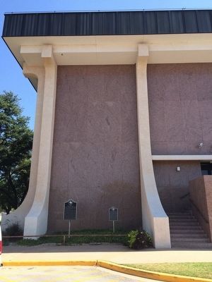
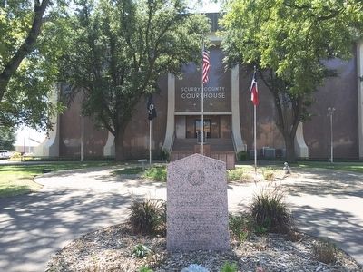
Location. 32° 43.001′ N, 100° 55.079′ W. Marker is in Snyder, Texas, in Scurry County. Marker is at the intersection of College Avenue (State Highway 350) and 25th Avenue (U.S. 180), on the right when traveling north on College Avenue. Touch for map. Marker is at or near this postal address: 1806 25th Avenue, Snyder TX 79549, United States of America. Touch for directions.
Other nearby markers. At least 8 other markers are within walking distance of this marker. County's First Law Men (here, next to this marker); Scurry County Honor Roll (within shouting distance of this marker); Company G (within shouting distance of this marker); County Named for Texas Confederate William R. Scurry (within shouting distance of this marker); Home County of Famous Frontiersman J. Wright Mooar (within shouting distance of this marker); Santa Fe Railway in Scurry County (within shouting distance of this marker); The Press in Snyder (within shouting distance of this marker); First State Bank Building (within shouting distance of this marker). Touch for a list and map of all markers in Snyder.
Also see . . . Kelly-Snyder Oilfield. (Submitted on September 21, 2015, by Mark Hilton of Montgomery, Alabama.)
Credits. This page was last revised on June 16, 2016. It was originally submitted on September 21, 2015, by Mark Hilton of Montgomery, Alabama. This page has been viewed 622 times since then and 38 times this year. Photos: 1, 2, 3. submitted on September 21, 2015, by Mark Hilton of Montgomery, Alabama.


