Bay City in Matagorda County, Texas — The American South (West South Central)
Elliott's Ferry
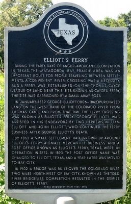
In January 1839 George Elliott (1806-1862) purchased land on the west bank of the Colorado River from Thomas Cayce, and from that time the ferry crossing was known as Elliott's Ferry. George Elliott was assisted in his endeavors by two nephews, William Elliott and John Elliott, who continued the ferry business after George Elliott's death.
By 1863 a small settlement had grown up around Elliott's Ferry. A small mercantile business and a post office known as Elliott's Ferry, Texas, were in operation in 1872. In 1893 the post office name was changed to Elliott, Texas, and a year later was moved to Bay City.
In 1902 a bridge was built over the Colorado River two miles northwest of Bay City. Known as the "Old River Bridge", its completion resulted in the demise of Elliott's Ferry.
Erected 1986 by Texas Historical Commission. (Marker Number 1461.)
Topics. This historical marker is listed in this topic list: Settlements & Settlers . A significant historical month for this entry is January 1839.
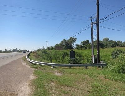
Location. 28° 59.015′ N, 95° 59.711′ W. Marker is in Bay City, Texas, in Matagorda County. Marker is at the intersection of State Highway 35 and Nile Valley Road, on the right when traveling west on State Highway 35. Touch for map. Marker is in this post office area: Bay City TX 77414, United States of America. Touch for directions.
Other nearby markers. At least 8 other markers are within 2 miles of this marker, measured as the crow flies. Dr. Henry Hofmann Loos (approx. 0.3 miles away); Site of Hilliard High School (approx. 1.1 miles away); Mother Zion Missionary Baptist Church (approx. 1.4 miles away); Bethel Baptist Church (approx. 1.4 miles away); St. Mark's Episcopal Church (approx. 1.4 miles away); Old Bay City Bank (approx. 1˝ miles away); Sugar Cane Mill (approx. 1˝ miles away); Bay City Post Office (approx. 1˝ miles away). Touch for a list and map of all markers in Bay City.
Also see . . . The Town of Elliott (AKA, Elliott's Ferry) in The Handbook of Texas. (Submitted on October 4, 2015, by Jim Evans of Houston, Texas.)
Credits. This page was last revised on June 16, 2016. It was originally submitted on October 4, 2015, by Jim Evans of Houston, Texas. This page has been viewed 806 times since then and 73 times this year. Photos: 1, 2. submitted on October 4, 2015, by Jim Evans of Houston, Texas. • Bernard Fisher was the editor who published this page.

