Fort Montgomery in Orange County, New York — The American Northeast (Mid-Atlantic)
A Strategic Location
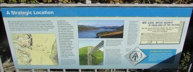
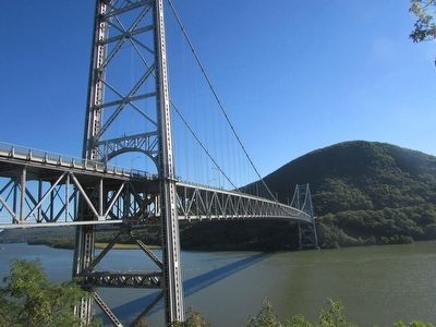
Built near the southern end of the Hudson River Highlands, the Bear Mountain Bridge is approximately 40 miles north of New York City and 90 miles south of Albany. Here, at Anthony’s Nose and Bear Mountain, the river narrows and the terrain becomes more rugged. This topography provided strategic military advantages during the American Revolution and was also ideal for the construction of a suspension bridge.
In 1776, Forts Montgomery and Clinton were built on the Hudson’s west bank and a massive iron chain was stretched across the river here. The chain was designed to restrict the movement of British ships. The British hoped to end the Revolutionary War by controlling the Hudson River and dividing the northern and southern colonies. The natural granite that once anchored the chain provided solid foundations for the bridge’s towers, and enabled its anchorage cables to be attached at minimal cost.
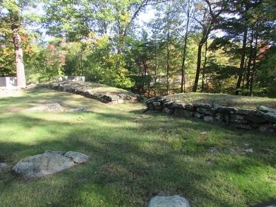
The forts and chain were destroyed by the British in October 1777. Fort Montgomery is now a National Historic Landmark and New York State Historic Site. Fort Clinton’s remains were largely obliterated in the 1920s during the construction of Bear Mountain Bridge. Portions of the fort’s West Redoubt are all that remain.
The Bear Mountain Bridge provides spectacular views of the Hudson Highlands, an approximately 15-mile section of the river between Peekskill and Newburgh.
The bridge project included the construction of a scenic road around Anthony’s Nose (now known as the Bear Mountain Road and the Goat Trail), a three-mile-long approach road that connects the bridge to the Albany Post Road and offered motorists a scenic drive similar to the 1919 Storm King Highway on the west side.
The Appalachian Connection
The very first section of the Appalachian Trail (AT) connected Bear Mountain to the Delaware Water Gap. Completed shortly after bridge construction began in 1923, it became a model for future trail sections. Bear Mountain Bridge connects the AT’s Mid-Atlantic and New England sections and is the only trail section that crosses tidal waters.
Topics. This historical marker is listed in these topic lists: Bridges & Viaducts • War, US Revolutionary.
Location. 41° 19.207′ N, 73° 59.28′ W. Marker is in Fort Montgomery, New York, in Orange County. Marker is on U.S. 202, on the left when traveling east. The marker is on the east side of the Bear Mountain Bridge, on the north side of the street. Touch for map. Marker is in this post office area: Fort Montgomery NY 10922, United States of America. Touch for directions.
Other nearby markers. At least 8 other markers are within walking distance of this marker. The Bridge Builders (here, next to this marker); Bear Mountain Bridge (a few steps from this marker); Popolopen Creek Trail to Fort Montgomery (within shouting distance of this marker); Fort Clinton (about 300 feet away, measured in a direct line); Appalachian Trail (about 400 feet away); Fort Clinton’s Outer Redoubt (about 500 feet away); a different marker also named Appalachian Trail (about 500 feet away); The British Attempt to Divide the Colonies during the War of Independence (about 500 feet away).
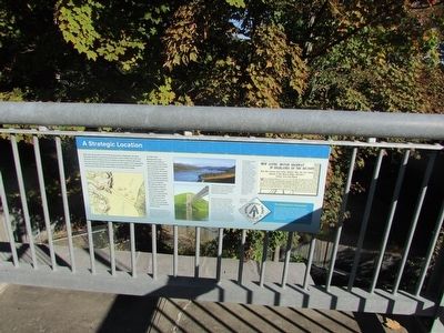
More about this marker. The bottom left of the marker contains a map showing Popolopen Creek and the Hudson River, along with Forts Montgomery and Clinton and the Great Chain. Photographs of the Bear Mountain Bridge and Hudson River appear at the center of the marker. A newspaper article announcing the scenic roadway mentioned on the marker is at the top right of the marker.
Credits. This page was last revised on June 16, 2016. It was originally submitted on October 10, 2015, by Bill Coughlin of Woodland Park, New Jersey. This page has been viewed 347 times since then and 16 times this year. Photos: 1, 2, 3, 4, 5, 6. submitted on October 10, 2015, by Bill Coughlin of Woodland Park, New Jersey.
