Near Platteville in Weld County, Colorado — The American Mountains (Southwest)
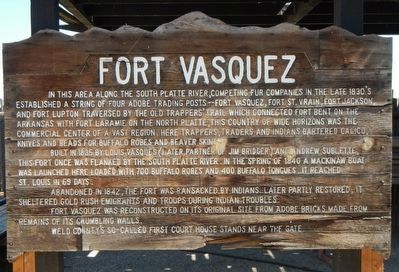
Fort Vasquez
In this area along the South Platte River, competing fur companies in the late 1830's established a string of four adobe trading posts -- Fort Vasquez, Fort St. Vrain, Fort Jackson and Fort Lupton traversed by the Old Trapper's Trail which connected Fort Bent on the Arkansas with Fort Laramie on the North Platte. This country of wide horizons was the commercial center of a vast region. Here trappers, traders and Indians bartered calico, knives and beads for buffalo robes and beaver skins.
Built in 1835 by Louis Vasquez (later partner of Jim Bridger) and Andrew Sublette, this fort once was flanked by the South Platte River. In the spring of 1840 a Mackinaw boat was launched here loaded with 700 buffalo robes and 400 buffalo tongues. It reached St. Louis in 69 days.
Abandoned in 1842, the fort was ransacked by Indians. Later partly restored, it sheltered gold rush emigrants and troops during Indian troubles.
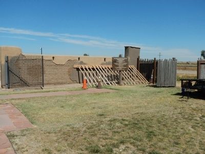
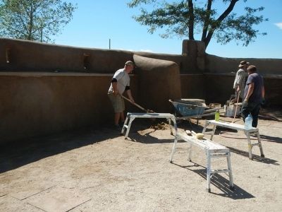
Fort Vasquez was reconstructed on its original site from adobe bricks made from remains of crumbling walls.
Weld County's so-called first court house stands near the gate.
Topics. This historical marker is listed in this topic list: Forts and Castles.
Location. 40° 11.662′ N, 104° 49.244′ W. Marker is near Platteville, Colorado, in Weld County. Marker is on U.S. 85, in the median. Touch for map. Marker is at or near this postal address: 13412 US Highway 85, Platteville CO 80651, United States of America. Touch for directions.
Other nearby markers. At least 8 other markers are within 17 miles of this marker, measured as the crow flies. A different marker also named Fort Vasquez (a few steps from this marker); Fort Vasquez / Fort Vasquez Country (within shouting distance of this marker); Fort Vasquez Trading Post (within shouting distance of this marker); Fort Lupton (approx. 6.7 miles away); Fort Junction (approx. 8.6 miles away); Evans / Dearfield / Colonies and Crusaders / Evans Country (approx. 14 miles away); Evans (approx. 14 miles away); Columbine Mine / Coal Field Country (approx. 16.8 miles away). Touch for a list and map of all markers in Platteville.
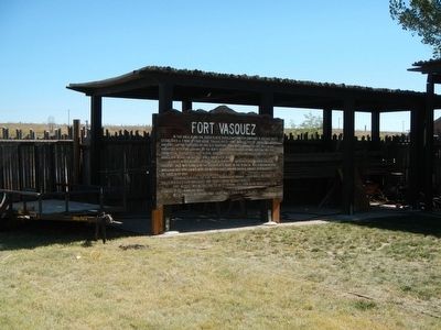
More about this marker. This marker is inside of the fort walls.
Also see . . . Fort Vasquez. Colorado Encyclopedia website entry (Submitted on November 18, 2022, by Larry Gertner of New York, New York.)
Credits. This page was last revised on November 18, 2022. It was originally submitted on October 13, 2015, by Barry Swackhamer of Brentwood, California. This page has been viewed 478 times since then and 20 times this year. Photos: 1, 2, 3, 4. submitted on October 13, 2015, by Barry Swackhamer of Brentwood, California.


