Near Sinclair in Carbon County, Wyoming — The American West (Mountains)
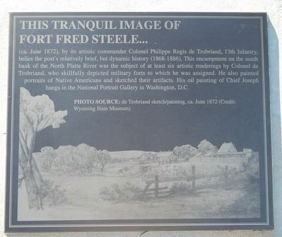
Image of Fort Fred Steele
Inscription.
This Tranquil Image of Fort Fred Steele... (ca. June 1872), by its artistic commander Colonel Philippe Regis de Trobriand, 13th Infantry, belies the post's relatively brief, but dynamic history (1868-1886). This encampment on the south bank of the North Platte River was the subject of at least six artistic renderings by Colonel de Trobriand, who skillfully depicted military forts to which he was assigned. He also painted portraits of Native Americans and sketched their artifacts. His oil paintings of Chief Joseph hangs in the National Portrait Gallery in Washington, D.C.
Erected by Wyoming Recreation Commission.
Topics. This historical marker is listed in this topic list: Arts, Letters, Music.
Location. 41° 46.669′ N, 106° 56.764′ W. Marker is near Sinclair, Wyoming, in Carbon County. Marker is on County Route 347 near Interstate 80, on the right when traveling west. Touch for map. Marker is in this post office area: Sinclair WY 82334, United States of America. Touch for directions.
Other nearby markers. At least 8 other markers are within walking distance of this marker. Rock Springs Massacre (here, next to this marker); Major General Philippe Regis de Trobriand (here, next to this marker); Major General Frederick Steele (here, next to this marker); Major Thomas Tipton Thornburgh (here, next to this marker); Thornburgh's Command (here, next to this marker); Viewing the Fort Grounds (within shouting distance of this marker); Fort Fred Steele after 1886 (within shouting distance of this marker); Enlisted Men's Barracks (about 300 feet away, measured in a direct line). Touch for a list and map of all markers in Sinclair.
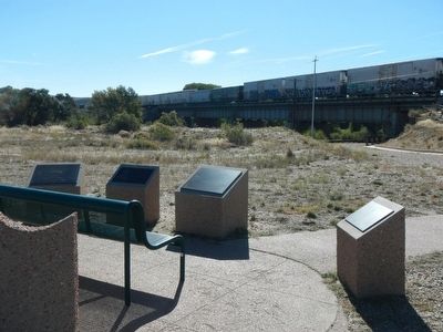
More about this marker. This marker, among a grouping of a half-dozen other markers, is located at Fort Fred Steele State Park on County Road 347, north of the Interstate 80 Exit 228 and on the north side of the railroad tracks near where County Road 347 passes beneath the railroad bridge.
Credits. This page was last revised on June 16, 2016. It was originally submitted on October 22, 2015, by Barry Swackhamer of Brentwood, California. This page has been viewed 345 times since then and 8 times this year. Photos: 1, 2. submitted on October 22, 2015, by Barry Swackhamer of Brentwood, California.

