Amador City in Amador County, California — The American West (Pacific Coastal)
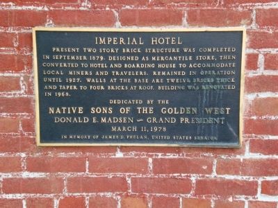
Imperial Hotel
Dedicated by the
Native Sons of the Golden West
Donald E. Madsen ~ Grand President
March 11, 1978
In Memory of James D. Phelan, United States Senator
Erected 1978 by Native Sons of the Golden West.
Topics and series. This historical marker is listed in these topic lists: Industry & Commerce • Notable Buildings. In addition, it is included in the Native Sons/Daughters of the Golden West series list. A significant historical month for this entry is March 1732.
Location. 38° 25.142′ N, 120° 49.496′ W. Marker is in Amador City, California, in Amador County. Marker is at the intersection of Main Street (Old State Highway 49) and Water Street, on the left when traveling south on Main Street. Touch for map. Marker is at or near this postal address: 14202 Hwy 49, Amador City CA 95601, United States of America. Touch for directions.
Other nearby markers. At least 8 other markers are within 2 miles of this marker, measured as the crow flies. Amador City Cemetery (about 300 feet away, measured in a direct line); Original Amador Mine (about 500 feet away); Keystone Mine (about 600 feet away); Bunker Hill Mine (approx. 0.4 miles away); South Spring Hill Mine (approx. half a mile away); Treasure Mine (approx. 0.8 miles away); Fremont-Gover Mine (approx. 1.3 miles away); New Chicago (approx. 1.4 miles away). Touch for a list and map of all markers in Amador City.
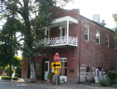
More about this marker. Marker is on the right corner of the building front.
Regarding Imperial Hotel. Originally on the site was a wooden hotel. After the big fire of 1878 destroyed almost every wood frame building on Amador City's main street, owner B. Sanguinetti erected the new building and later a two-story frame addition (which was removed years later) behind it to house the overflow. It remained a hotel until 1927. In 1968, careful restoration returned the building to its original use, making it once again a functioning hotel. Six rooms, each with a private bath, high ceilings and proudly displaying the original brick walls. The hotel also has a restaurant and bar. Additionally, there is a courtyard highlighted by fountains, waterfalls, flower gardens and century-old walls of native stone.
Also see . . . The Imperial Hotel. "Today the miners are gone, but Amador City retains its historic character, and the beautifully restored Imperial Hotel still offers a warm and gracious welcome to visitors to the Gold Country." (Submitted on July 10, 2008, by Kevin W. of Stafford, Virginia.)

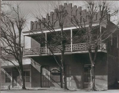
Photographed By Unknown, 1939
4. Imperial Hotel (photo courtesy of the Bancroft Collection, Univ. of California)
Note in 1939 there were 3 trees in front of the hotel - only one and the stump of another have survived. Note, too, the presence of a wooden structure on the left side which has since disappeared.
Credits. This page was last revised on June 16, 2016. It was originally submitted on July 9, 2008, by Andrew Ruppenstein of Lamorinda, California. This page has been viewed 1,854 times since then and 12 times this year. Photos: 1, 2. submitted on July 9, 2008, by Andrew Ruppenstein of Lamorinda, California. 3. submitted on March 15, 2009. 4. submitted on July 9, 2008, by Andrew Ruppenstein of Lamorinda, California. • Kevin W. was the editor who published this page.


