Shadyside in Pittsburgh in Allegheny County, Pennsylvania — The American Northeast (Mid-Atlantic)
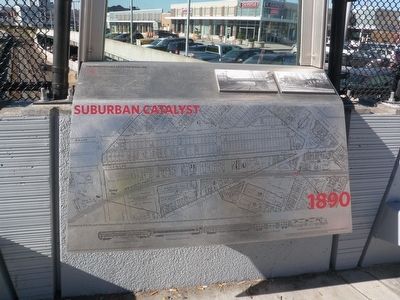
Suburban Catalyst
1890
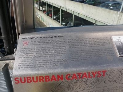
— The Pennsylvania Railroad Mainline —
The Main Line, which first connected Philadelphia and Pittsburgh in 1852, is significant locally for fostering the growth of some of Pittsburgh's earliest suburbs. Shadyside and East Liberty, the two neighborhoods connected by the South Highland Avenue Bridge—the bridge at your feet—were largely farmland until the PRR arrived—and with it, commuter service to downtown.
Soon the world's wealthiest industrialists were moving their families here beyond the smoky working-class districts. In 1868, the Main Line spurred annexation into the city of twenty-one square miles of rapidly expanding East End Suburbs.
By 1876, the first bridge on this site was completed as part of a program to improve safety by eliminating at-grade crossings. Over the years, the bridge was reinforced a number of times, in part to accommodate heavier streetcar and automobile traffic. The superstructure was replaced in 1925 and again in 2013, though the 1876 stone pier and abutments remain underneath.
Rail travel declined in the early 20th century as the automobile increased access to more remote suburbs. By the early decades of the 21st century, what was once the four-track Main Line was carrying Norfolk Southern freight trains and daily Amtrak passenger trains on two tracks with bus riders commuting on the adjacent East Busway.
Erected 2013 by Federal Highway Administration, Pennsylvania Department of Transportation, City of Pittsburgh.
Topics. This historical marker is listed in these topic lists: Bridges & Viaducts • Industry & Commerce • Railroads & Streetcars. A significant historical year for this entry is 1852.
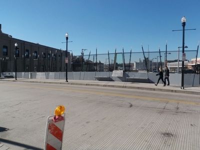
Location. 40° 27.546′ N, 79° 55.511′ W. Marker is in Pittsburgh, Pennsylvania, in Allegheny County. It is in Shadyside. Marker can be reached from South Highland Avenue, 0.1 miles south of Centre Avenue, on the right when traveling south. This marker is part of a display erected on the sidewalk parapet of the newly refurbished South Highland Avenue Bridge. Touch for map. Marker is in this post office area: Pittsburgh PA 15206, United States of America. Touch for directions.
Other nearby markers. At least 8 other markers are within walking distance of this marker. Portal of Industry (a few steps from this marker); Motor Square Garden (about 600 feet away, measured in a direct line); East Liberty Presbyterian Church (approx. 0.2 miles away); Calvary Episcopal Church (approx. ¼ mile away); Sacred Heart Church (approx. ¼ mile away); 1st Drive-In Filling Station (approx. 0.3 miles away); The Highwood (approx. 0.3 miles away); St. Peter's Evangelical and Reformed Church (approx. 0.3 miles away). Touch for a list and map of all markers in Pittsburgh.
Also see . . . Pennsylvania Railroad Technical and Historical Society. (Submitted on November 5, 2015, by Mike Wintermantel of Pittsburgh, Pennsylvania.)
Photographed By Mike Wintermantel, November 4, 2015
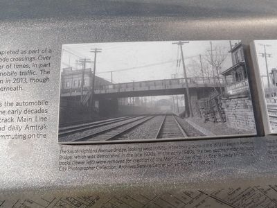
4. The Bridge in 1915
The South Highland Avenue Bridge, looking west in 1915. In the background is the 1872 Ellsworth Avenue Bridge, which was demolished in the late 1970s. In the early 1980s, the two southernmost railroad tracks (lower left) were removed for creation of the Martin Luther King, Jr. East Busway (Pittsburgh City Photographer Collection, Archives Service Center, University of Pittsburgh).
Photographed By Mike Wintermantel, November 4, 2015
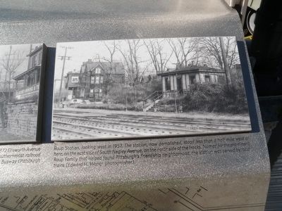
5. Roup Station
Roup Station, looking west in 1957. The station now demolished, stood less than a half mile west of here, on the east side of South Negley Avenue, on the north side of the tracks. Named for the prominent Roup Family that helped found Pittsburgh's Friendship neighborhood, the station was served by local trains (Edward H. Weber, Photographer).
Credits. This page was last revised on February 2, 2023. It was originally submitted on November 5, 2015, by Mike Wintermantel of Pittsburgh, Pennsylvania. This page has been viewed 349 times since then and 8 times this year. Photos: 1, 2, 3, 4, 5. submitted on November 5, 2015, by Mike Wintermantel of Pittsburgh, Pennsylvania.
