Oyster Bay in Nassau County, New York — The American Northeast (Mid-Atlantic)
A Garden for Food and Color
Sagamore Hill National Historic Site
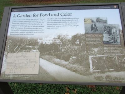
In Theodore Roosevelt’s time this field was a three-acre garden of vegetables, fruit trees, and berries. It produced potatoes, lima beans, lettuce, and carrots, peach, plum, and pear trees, and multiple grape arbors. Despite its size the garden was not big enough to take care of all their mealtime needs. The garden also provided many scents and colors. Edith Roosevelt loved flowers throughout the house, so the garden included carnations, snapdragons, salvia, columbine, and larkspur for cuttings and table settings.
Alfred Davis, who had worked for the Roosevelt family all his life, developed the garden soon after Roosevelt purchased Sagamore Hill. He tilled the soil, made sure the plants got water, and tried to keep the Roosevelt children from “tramping on his flower beds, eating his grapes and currants.”
Erected by National Park Service.
Topics and series. This historical marker is listed in this topic list: Notable Places. In addition, it is included in the Former U.S. Presidents: #26 Theodore Roosevelt series list.
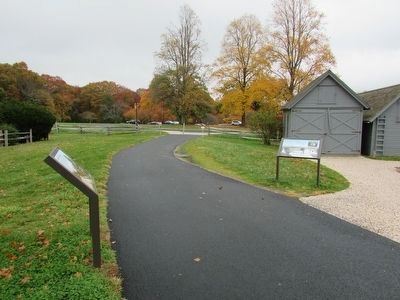
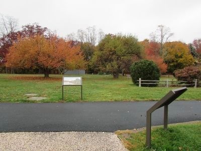
Location. 40° 53.183′ N, 73° 30.008′ W. Marker is in Oyster Bay, New York, in Nassau County. Marker can be reached from Sagamore Hill Road, on the right when traveling north. Marker is located at Sagamore Hill National Historic Site, behind the Visitor Center. Touch for map. Marker is in this post office area: Oyster Bay NY 11771, United States of America. Touch for directions.
Other nearby markers. At least 8 other markers are within walking distance of this marker. Helping Feed the Family (a few steps from this marker); Farm Tools (a few steps from this marker); The Garden (a few steps from this marker); Chicken House (within shouting distance of this marker); Stable and Grooms’ Quarters (within shouting distance of this marker); The First Building (within shouting distance of this marker); Wood and Tool Shed (within shouting distance of this marker); A Gentleman’s Farm, 1918 (within shouting distance of this marker). Touch for a list and map of all markers in Oyster Bay.
More about this marker. The background of the marker contains a photograph depicting a view of the garden and arbor. The bottom left of the marker features a map of the garden drawn by Ethel and Archie Roosevelt around 1965 at the request of the National Park Service. The upper right of the marker contains a photograph with a caption of “Robert Ferguson plays with family pet, Brian, in front of the Gardener’s Shed, around 1895. Typically used to store garden equipment, Alfred Davis made this building his home during the warmer months of the 1890s.” Next to this is a photo of “Alfred Davis with Ethel Roosevelt around
1898. The Roosevelt children would follow him around the garden, picking up anything that caught their interest. He would tell them to put it down and ‘leave it be,’ so they called him “Old Leave It Be.”
Also see . . . Sagamore Hill National Historic Site - National Archives. National Register of Historic Places documentation (Submitted on March 28, 2024, by Anton Schwarzmueller of Wilson, New York.)
Credits. This page was last revised on March 28, 2024. It was originally submitted on November 7, 2015, by Bill Coughlin of Woodland Park, New Jersey. This page has been viewed 282 times since then and 13 times this year. Photos: 1, 2, 3. submitted on November 7, 2015, by Bill Coughlin of Woodland Park, New Jersey.


