Near Pound in Wise County, Virginia — The American South (Mid-Atlantic)
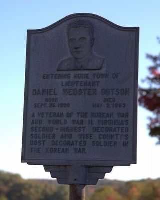
Daniel Webster Dotson
Topics. This historical marker is listed in these topic lists: War, Korean • War, World II. A significant historical year for this entry is 1920.
Location. 37° 9.332′ N, 82° 37.382′ W. Marker is near Pound, Virginia, in Wise County. Marker is at the intersection of Orby Cantrell Highway (U.S. 23) and Potter Town Road (County Route 667), on the right when traveling south on Orby Cantrell Highway. Touch for map. Marker is in this post office area: Pound VA 24279, United States of America. Touch for directions.
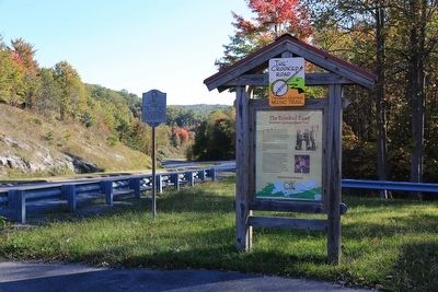
Other nearby markers. At least 8 other markers are within walking distance of this marker. The Crooked Road (here, next to this marker); Pound Gap Engagement (within shouting distance of this marker); Pound Gap (approx. 0.4 miles away); Leonard Woods Lynched (approx. 0.4 miles away); Wise County / Kentucky (approx. half a mile away); Caudill’s Army (approx. 0.6 miles away in Kentucky); Brothers Once More (approx. 0.6 miles away in Kentucky); Pound Gap Massacre (approx. 0.6 miles away in Kentucky). Touch for a list and map of all markers in Pound.
Credits. This page was last revised on June 16, 2016. It was originally submitted on November 20, 2015, by J. J. Prats of Powell, Ohio. This page has been viewed 485 times since then and 18 times this year. Photos: 1, 2. submitted on November 20, 2015, by J. J. Prats of Powell, Ohio.

