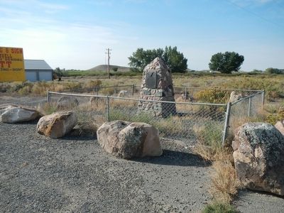
Lovell in Big Horn County, Wyoming — The American West (Mountains)
The Mormon Colonists
The Mormon Colonists
of the Big Horn Basin
who, under the leadership of
Abraham O. Woodruff, first camped near this site in May 1900. These pioneers, under many difficulties, established towns, notably Byron, Cowley and Lovell, organized the Big Horn Stake of Zion, constructed the Sidon Canal, built railroads and pioneered education through founding the Big Horn Academy.
Erected 1935 by The Aaronic Priesthood Quorums of the Big Horn Stake and Utah Pioneer Trails and Landmarks Association. (Marker Number 58.)
Topics and series. This historical marker is listed in this topic list: Settlements & Settlers. In addition, it is included in the Utah Pioneer Trails and Landmarks Association series list.
Location. 44° 50.496′ N, 108° 26.37′ W. Marker is in Lovell, Wyoming, in Big Horn County. Marker is on West Main Street (U.S. 310) near Alternate U.S. 14A, on the right when traveling east. Touch for map. Marker is at or near this postal address: 1783 West Main Street, Lovell WY 82431, United States of America. Touch for directions.
Other nearby markers. At least 8 other markers are within 11 miles of this marker, measured as the crow flies. The Jeep (approx. 2.4 miles away); Henry Gilbert, Jr. Memorial (approx. 2.4 miles away); Cowley Log Community Center (approx. 3.1 miles away); Big Horn Academy (approx. 3.2 miles away); Big Horn LDS Stake Office and Tithing Building (approx. 3.2 miles away); Byron Sessions (approx. 4.3 miles away); Sidon Canal (approx. 8 miles away); Deaver Reservoir (approx. 10.4 miles away). Touch for a list and map of all markers in Lovell.
Credits. This page was last revised on June 16, 2016. It was originally submitted on December 4, 2015, by Barry Swackhamer of Brentwood, California. This page has been viewed 419 times since then and 35 times this year. Photos: 1, 2. submitted on December 4, 2015, by Barry Swackhamer of Brentwood, California.

